
Author: Val Dodge
Supermarket finds: Spicy cock soup

If you’ve ever wondered, Spicy Cock soup has just 40 calories and 31% of your recommended daily sodium intake per serving. Not that there’s anything wrong with that.
Branding problem
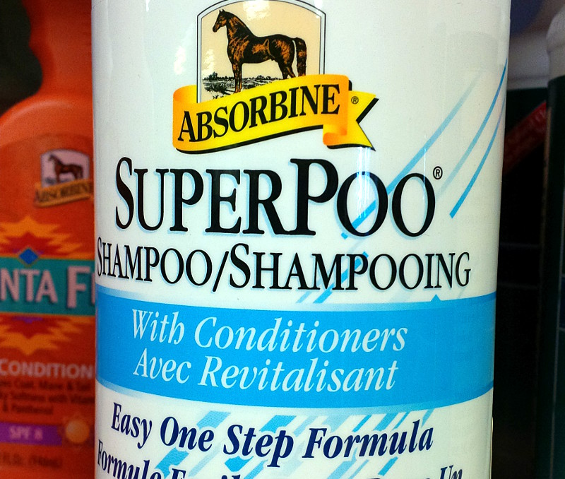
Houston, we have a branding problem.
It may include conditioners, apply in just one step, and be apple-scented, but I’m just not convinced I’d want to clean my horse with SuperPoo.
Mophie loves me
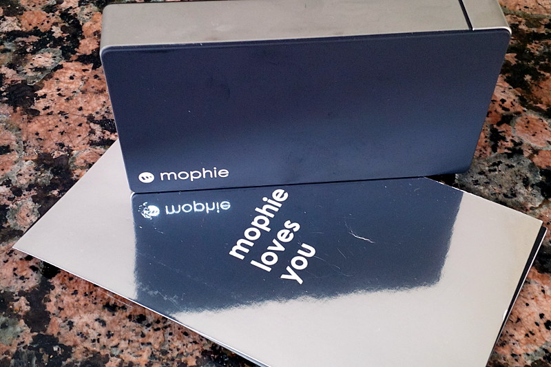
The user manual for my Mophie portable power pack proclaims its undying love for me.
Dear Mophie,
Like a lot of people, I first met you after December’s ice storm. I suddenly found myself with things to charge and few places to charge them. The backup battery for my phone was great for my phone, but not for anything else. And it only gave me one charge, not nearly enough for three days without power. We took refuge at my mother-in-law’s, who had more than enough power to go around, but the ordeal made me realize just how vulnerable I am to power outages. I felt mortal. Weak. A poor provider. So once cats, wife, and laptop were safely provisioned in a warm house, I set out to find comfort in a portable power pack.
I found you in Future Shop, looking lonely on the rack and offering up promises of exactly the kind of portable power storage I needed. I gave you a quick once over. With two quick-charge USB ports, you’d be fast off the mark and reach the finish line without a lot of waiting. I asked the guy at the counter about you and he said we’d be perfect together. He gave me a knowing wink and added that you’d be able to charge me three or four times before I’d have to charge you even once. I nodded silently, thinking, Huh, that sounds pretty good. You were stylish, if a little chunky. A little more than I was hoping to spend for a quick charge, but hey, any USB port in an ice storm. After some quick pleasantries, I paid your tab at the cashier and took you home.
I thought we had an understanding that this was just an arrangement of convenience; no pressure, and only the barest thought given to long-term compatibility. So I was a little surprised when I started unboxing you at home only to have you declare your love for me almost immediately. “Mophie loves you,” you said, channelling George Costanza in the third person. “Let’s just see how this goes for a little while first,” I said. You blinked a couple of LEDs at me as I plugged you in, and everything seemed fine.
We’ve had a few charges in the weeks since then and the guy at the counter was right: I can charge you once and then just sit back while you charge me over and over again. It’s given me some measure of comfort knowing that when the darkness comes again, I’ll be able to wrap your cables around my phone and keep the LTE lit up for a few days.
But your words linger in the back of my mind. Mophie loves you. I threw out your clamshell a long time ago, knowing that I wouldn’t need to kick you out, and you go with me virtually everywhere now, providing silent support should I ever need it. But I still have your receipt on top of the pile. I’m obviously not completely comfortable with the way things are. It’s not that I don’t like you, but…”Mophie loves you.” That’s tough to swallow right off the bat, and it’s just kind of been hanging out there since our first encounter. You haven’t pushed it, but it’s a definite undercurrent in our relationship. And with Valentine’s Day behind us, it’s about time that I address it.
Mophie, I don’t love you. Don’t get me wrong, I like you and all, but I just don’t see us having a long-term future. Sure, 500 charges sounds like a lot, but realistically, that’s only a couple of years before you start getting old and don’t charge me up the way you used to. And other than charging, we don’t really have a lot in common. By this time next year, I’ll be eyeing some fresh new power packs that will weigh half as much, deliver just as much of juice on demand, and won’t be nearly as clingy. I mean, let’s face it: the only reason I picked you is because you were the only one left on the shelf, the joint was getting ready to close, and I was kind of desperate. There may have been a reason you were the last one sitting around that day. Everyone you’d arrived with had already partnered up and left; why were you still hanging around? I don’t think I’ll ever really know, but I’ll always have my doubts.
Anyway, I wasn’t in the best frame of mind when we met and certainly had no intention of committing to anything long term. I do appreciate the support you’ve given me so far but let’s park the “Mophie loves you” talk for now. I’m happy to keep using you for the occasional power trip. In return I’ll keep you charged up as much as possible and take you with me whenever I go somewhere. Let’s just be friends, with power benefits.
Sincerely,
Val
Supermarket Finds: Chocolate Soda

I saw a row of President’s Choice Decadent Chocolate Flavoured Soda bottles on a shelf at Loblaws around Christmas and had to pick one up to Risa’s vocal disapproval. It’s for science, I told her. Think of the kids whose lives would be immeasurably improved if I, instead of they, drank this limited-availability monstrosity. Well, it finally made it into my testing lab and it’s not quite what I expected. Oh, in at least one way it’s exactly what I hoped it would be: a vaguely disgusting carbonated concoction that would slip past my lips once and never again tempt me to slip a fiver to the store clerk who would quietly slide my shame into a plain paper bag so that I could secretly imbibe on my way home, the sugar rush dulling the self-flaggelation over my lack of willpower. It’ll never happen again, I’d tell myself. Until the next time.
Instead, this is disgusting in a way that I didn’t expect. I had expected it to taste like a bad imitation of a chocolate chip cookie dipped in Coke, a guilty pleasure I enjoyed far too often during my youth. And since I love (but now rarely touch) both Coke and chocolate chip cookies, I was quite looking forward to the can of whoop-ass I was about to open on my senses.
Upon unscrewing the lid, I was almost overcome by the twin smells of caramel and chocolate, as if I’d dropped a bag of chocolate chips into a warm mug of Kraft Caramels. The taste was much closer to drinking a sickly sweet box of Pot of Gold chocolates than any cookie I’ve ever had. The after-taste was a medley of mint and disappointment, not at all dissimilar from a late-night hunt through the pantry looking for sweets and finding only a stash of After Eights.
It’s definitely flavourful, but not in a very good way. They would have been better served by selling Coke in a wide-mouth bottle with a couple of chocolate chip cookies for dipping strapped to the side. The hunt for a carbonated mashup that’s actually good continues.
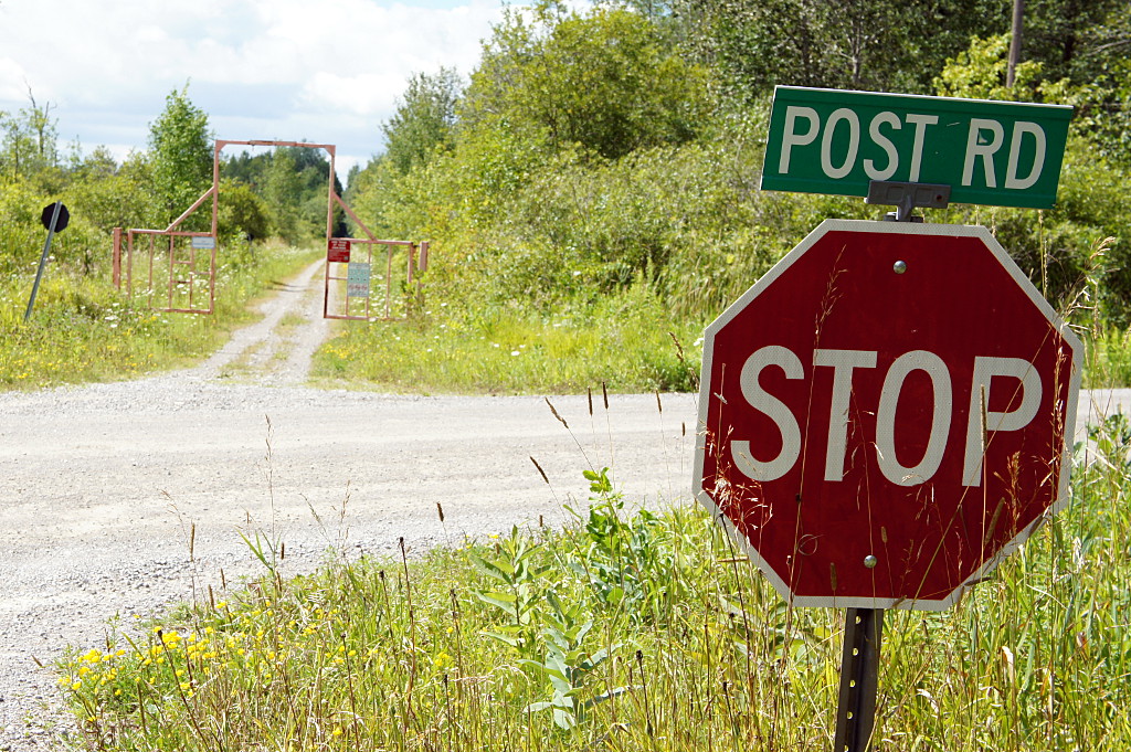
Friday the 13th
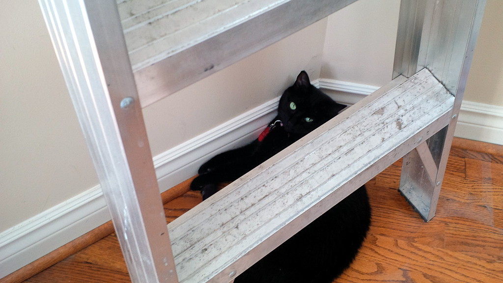
Black cat under a ladder on Friday the 13th; what could possibly go wrong?
(She was taking a break after spending the morning breaking a mirror, spilling salt, and opening an umbrella inside.)
The road to health
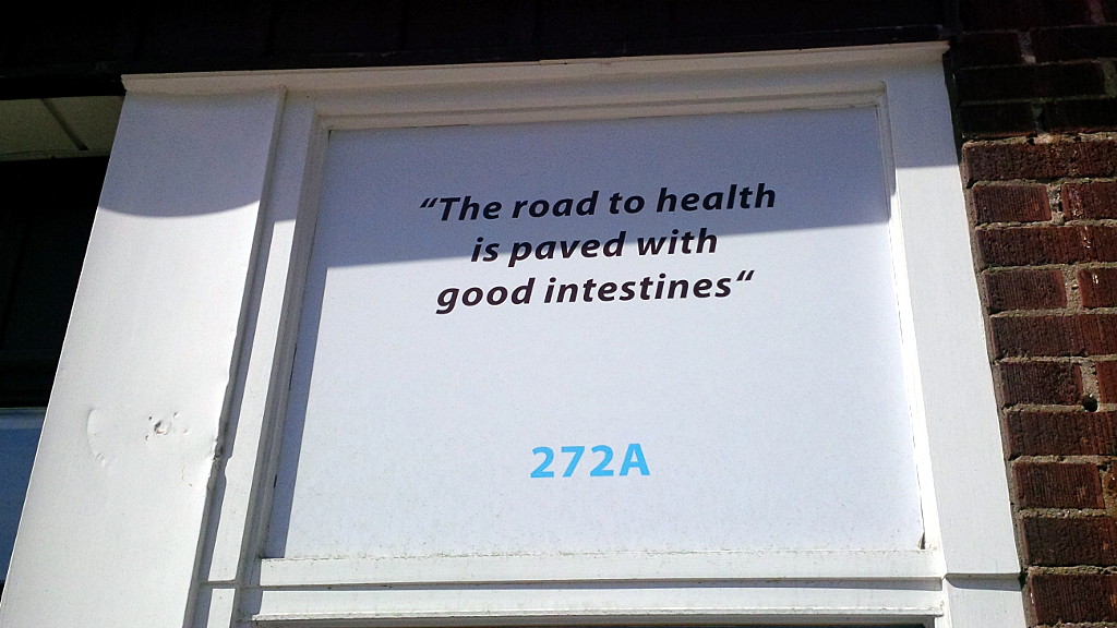
Can’t argue with that.
(Seen on Danforth.)
Lindsay to Bethany rail trail
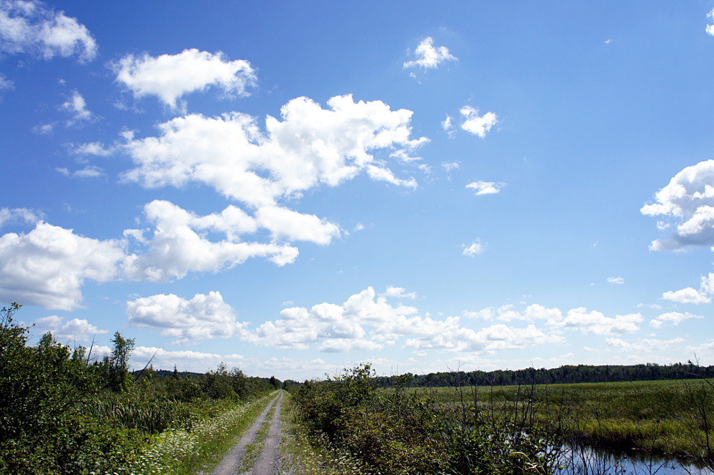
A wetland view from the Lindsay to Bethany rail trail.
Continuing my exploration of the many rail trails in the Greater East Dodgeville Area, I rode the Lindsay-Bethany trail last month. The trail runs southeast from Lindsay to Bethany and is the southernmost section of the Victoria Rail Trail, which runs all the way up to Haliburton. Like most trails in the area, the surface is highly variable, sometimes changing between loose gravel, sand, mud, grass, and crushed gravel all in the course of a few hundred metres. At the very southern end past Bethany, a portion of the trail has perfectly spaced and sized depressions; it feels like riding a mini pump track and is way more fun than you’d expect riding on a straight rail trail would be. Most of the trail is hard-packed double track that’s easy enough to ride on, but you do have to be ready for the occasional potholes and surface changes that come with a trail that isn’t quite up to Trans Canada Trail standards like the Omemee and Hastings trails are. I seem to say this of a lot of trails, but I wouldn’t recommend it for hybrids or road bikes. It’s quite acceptable on a decent mountain bike, with or without front suspension. Of all the trails I’ve been on recently, it’s also the most heavily used by ATVs: I encountered close to a dozen of them in the first few kilometres riding out of Lindsay on a sunny Sunday afternoon, though there were none on the last half of the trail to Bethany.
You always know where you are on the Lindsay-Bethany trail
One thing does set the Bethany trail apart from all of the other trails I’ve been on recently: it feels very isolated. While most other trails pass behind backyards and farm fields, the Bethany trail spends a lot of time skirting large wetlands and valley forests while the Pigeon River and Fleetwood Creek meander back and forth with no farm fields or houses anywhere in sight. Even road crossings become rare on the southern half of the trail, making the whole experience feel more wild and natural than other trails, even knowing that the farms and quarries are still there, just a little out of sight.
Another rare sight is clearly visible at every intersection where the trail crosses a road: signs! No, not the stop signs, but honest-to-goodness street signs. It’s the first trail I’ve been on where every intersection is marked so that you don’t have to guess which road you’re crossing. It’s a wonder that more trails don’t have this simple nod to the fact that people may want to know where they are.
Read on for the ride gallery.
Kingston to Cobourg, Day 2: Blow the man down!
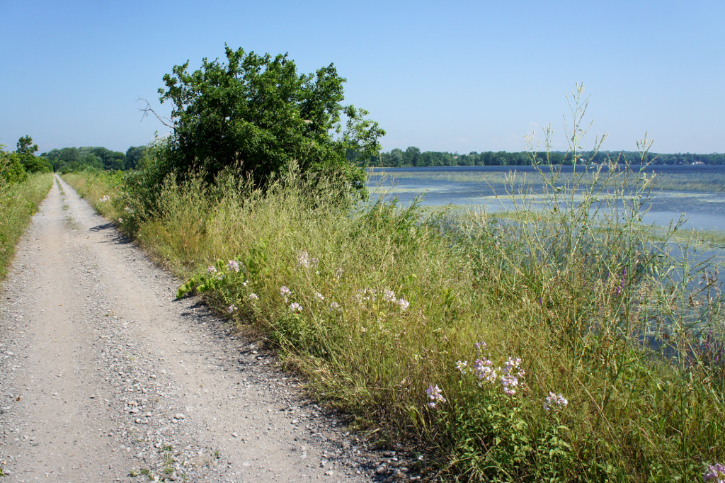
The Millennium Trail in Prince Edward County.
Nothing gets you going in the morning like a hearty French toast breakfast, and Magnolia Meadows host Isabelle didn’t disappoint. An hour after polishing off a stack of French toast, a pot of tea, and a glass of juice, I was ready to hit the road again on Day 2 of my mid-July ride from Kingston to East Dodgeville. It was just a bit cooler than it had been the previous day, but still uncomfortably hot as I got underway shortly after 10 a.m. But the killer this day wasn’t the heat or the humidity; it was the wind. Blowing briskly from the west at a steady 40 km/h (and gusting to 60 km/h), Old Man Wind’r would be my nemesis for the next few hours as my route took me straight into his gaping maw.
The Friday ride was to start with a short stretch along the main rail trail in Prince Edward County, the Millennium Trail, before moving onto local roads for the majority of the ride into Cobourg. I joined the trail a short distance north of the B&B. I’ve shared trails with dirt bikes, ATVs, and even full-sized touring motorcycles, but this was the first time I’ve ever had to share a rail trail with golf carts: in Wellington, the trail goes through a golf course and carts zip onto the trail for short distances to get to the next hole. Fortunately, it only takes a couple of minutes to get past the course and I only saw a couple of carts.
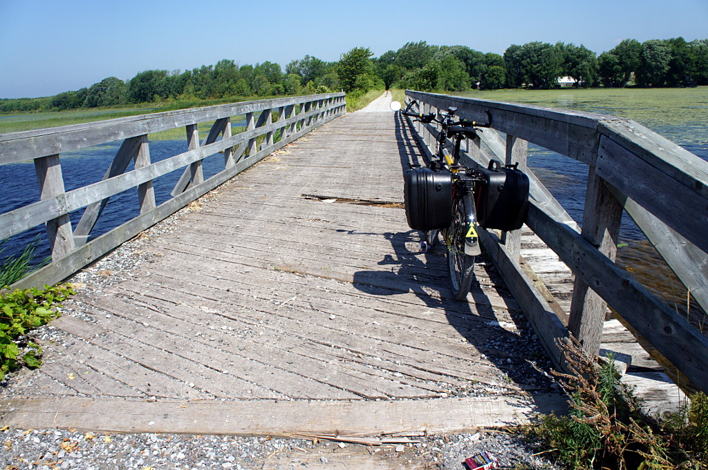
A causeway carries the Millennium Trail across Consecon Lake. I hope there’s a bridge at the far end.
This day’s route called for me to stay on the rail trail for 3-4 km and then venture back onto the roads for the rest of the day. But with the open road came my first taste of the headwind that would bedevil me for the rest of the day. After a few minutes, I scurried back to the trail and the sheltering vegetation lining both sides and keeping the wind to a minimum. Although the trail surface varied from smooth limestone dust to sandy double track and large gravel, it was far easier to maintain a good pace on the rail trail than to battle the wind.
Being beaten back to the trail turned out to be a blessing in disguise because the Millennium Trail was easily the best part of the ride on either day. The wind was controlled, the scenery beautiful, and the trail was wholly deserted: I didn’t encounter a single person on the trail after I passed the golf course on my way out of Wellington.
The only problem: at one point, my GPS and my printed Google maps disagreed over whether the trail continued across a bridge over Consecon Lake up ahead. Should I keep going on the trail or return to the road grid to get around this potential dead end? I decided that I’d rather have to double back on the trail than ride on the road if I didn’t absolutely need to, so up the trail I went. In the end, Google was right: the trail followed a causeway out across Consecon Lake and an old bridge did indeed span the gap that my GPS showed. And the bridge was a little more confidence inspiring than it was in 2004.
Most of the Millennium Trail isn’t in good enough condition for casual cyclists on hybrid or city bikes, but it’s a easily ridable on anything with wider tires. It was a pleasure to ride on a front-suspension mountain bike, but rigid forks and well-padded gloves would have done just as well. The entire trail northwest from Wellington is a great ride. Next time, I’ll ride it all the way from the eastern end of the County in Picton. But all good rail trails must come to an end and I rejoined the road to cross the western end of the Murray Canal outside Brighton. Away from the busy Loyalist Parkway, the crossing at this end of the canal is much quieter and allows you to skirt Brighton rather than going through the town on major streets. Highly recommended for all cyclists riding between Wellingon and Presqu’ile. Unfortunately on this day, with the open road came the fierce wind and the afternoon heat, kilometre by kilometre sapping my will to ride.
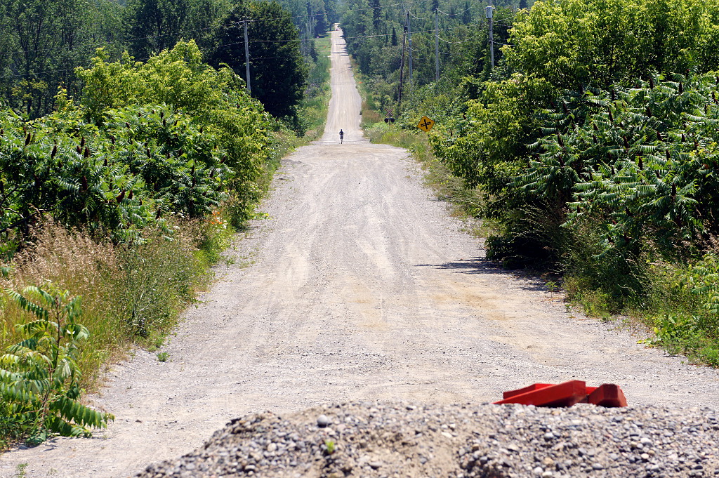
From the closed bridge on Barnes Road, a lone jogger plods down the deserted and very hot road.
I rode through the south end of Brighton, past Presqu’ile Provincial Park and toward Cobourg, my target for the day. I wanted to stick as close to the lake for as long as possible before joining the main road to Cobourg, so I took a chance when I saw a “bridge closed” sign directing me up to the highway as a detour. It meant I’d be rolling the dice for a second time in one day on a potentially non-existent bridge, but what the hell; at least I’d have a tailwind for a few minutes if I had to backtrack. Two and a half kilometres after the sign, a gravel barrier blocked vehicular access to the railway overpass on Barnes Road, but it was obviously still well-used by pedestrians. I hefted my bike over the pile of gravel and sat down for lunch on the bridge, just a few hundred metres short of the road to Cobourg.
At this point, it was clear that finishing the ride all the way to Cobourg would be a serious challenge. Although this day’s ride was planned to be around 25 km shorter than the previous day’s, the wind was taking so much out of me that it might as well have been 50 km longer. As I turned onto the main road west to Cobourg and back into the full-on headwind, I knew I was defeated. I slogged through Salem, Colborne, and Wicklow before finally succumbing to the heat and wind at Grafton, calling Risa to pick me up about 15 km short of our planned meeting place in downtown Cobourg. By that time, my pace had been slowing down so steadily that my GPS had been declaring Cobourg to be just an hour away for the previous 45 minutes.
I’d definitely do the entire ride again if I had the chance, but I’d order up cooler weather and a much lighter breeze next time. And barring that, I’d head east with the wind, rather than west into it. That said, I highly recommend the entire route I took. I’d make more detours with more time and more bike-friendly weather, but the route was an excellent combination of being away from traffic on backroads and quiet trails, together with scenic highways when necessary. If I’d been on a road bike, I would have had to stick a little closer to civilization for most of the second day. It’s one reason that I like doing tours on my mountain bike: it can be a bit more challenging if I’m just riding along paved roads, but it gives me a lot more freedom when it comes to selecting a route and making detours along the way.
I bracketed this ride with a bus trip to Kingston and a car pickup in Cobourg, but the trip could just as easily have started with a train ride to Kingston and ended at the Cobourg VIA station for a ride back to Toronto. Or add an overnight stay in Cobourg and a third day of riding to the GO bus in Newcastle or GO train in Oshawa.
The gallery from the ride is below the fold.
Kingston to Cobourg, Day 1: Hot, hot, hot!
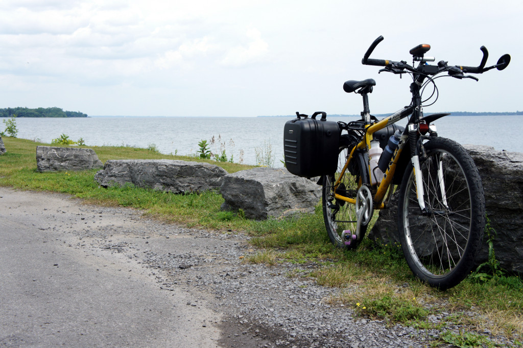
Finkle’s Shore Park on the Loyalist Parkway west of Bath.
I have a piece of advice for anyone thinking about doing a two-day bike tour: make sure that the humidex is below 40°C on the first day and don’t opt for a cooling breeze in the form of a constant 45 km/h headwind—gusting to over 60 km/h—to make the second day easier going. If you are unable to arrange either of these things, you’ll end up with my two-day ride from Kingston to Cobourg last month: withering heat one day, and withering heat plus an energy-sapping headwind the next. Although I highly recommend the route and had a very enjoyable ride, the weather made it much more challenging than it would have been otherwise. Between the heat radiating off the baking asphalt and fierce headwinds pushing me back up hills I’d just fought my way down, “brutal” was the word that came to mind—and frustrated lips—on several occasions over the two days.
I mentioned in a previous post that I was in Kingston for a conference last month, which coincided with the beginning of my vacation. I decided to bring my bike on the bus with me from Toronto and make the return trip into a short bike tour from Kingston to East Dodgeville. And so I found myself pushing a loaded bike away from the curb in downtown Kingston late one sunny Thursday morning in July. The humidex was already pushing 40° but I had plenty of water, food for two meals on the road, and a number of planned stops before I’d roll into my B&B in Wellington a few hours later. The day started to unravel just ten minutes later, when I found myself desperately seeking a shade tree where I could fix my flat tire out of the burning sun.
By the time I’d swapped out the old tube and found the culprit—damn you, staple!—I’d lost half an hour and a good deal of energy. Mini-pumps are great, but 100 strokes for every 10 PSI can take a lot out of you. The rough start was forgotten once I got back onto the road and left Kingston behind. My first-day route to Wellington in Prince Edward County mostly followed the waterfront, but I ventured away from Lake Ontario for a while to visit the abandoned Ernestown station. That inland jog was where I really started feeling the heat. It wasn’t so bad as long as I was moving and had a bit of a breeze in my face, but the first time I stopped to take a picture it was like I’d stepped into an oven. I almost leapt back onto the saddle to get moving again. I had originally planned to stay inland inland for a few more kilometres from Ernestown, but I decided to bust it straight back down to the water, hoping it might be a bit cooler along the lake. That little breeze off Lake Ontario is what kept me going for the next couple of hours.

When they say that this is a shore road, they’re not kidding. There’s basically nothing between the road and the water except that guardrail and a thin layer of gabardine.
Google defaults to suggesting a route from Kingston to Cobourg farther inland through Napanee and Belleville, but I opted for the Waterfront Trail/Loyalist Parkway to Adolphustown, across the Glenora ferry, and through Prince Edward County. Once you pass Bath outside Kingston, traffic on the road is relatively light. After you pass the road that goes north to Napanee, the final 20 km or so along the peninsula to the ferry is very quiet. So much so that eventually you realize that if the ferry isn’t running for some reason, you’ve got a long, lonely ride back to civilization. Check the schedule and ferry status before you leave!
Fortunately, the ferry runs often enough in the summer months that wait times are minimal. And once you cross into Prince Edward County, you’ve got many choices for riding: the main road and a rail trail both lead directly into Wellington, or you can tootle away on the grid of backroads if that’s your thing. I’d have been happy to spend more time exploring the options, but by the time I got into The County, it felt like my shirt had melted into my skin and I just wanted to have a cool shower and a sit-down dinner, in that order. Did I mention that it was hot? It was hot!
I rolled up to Magnolia Meadows, a B&B that I’d found via the Welcome Cyclists website, early on Thursday evening. My hosts, Bob and Isabelle, were friendly and accommodating, storing my bike safely in the garage overnight. Isabelle makes a mean breakfast, but I’ll get to that in my next post.
There’s just one thing about Wellington: this tourist town rolls up for the night very early by Toronto standards: by the time I headed out for dinner at 8 p.m. on Thursday evening, still almost an hour before sunset, only one restaurant and a convenience store were open. Even the grocery store was closed up tight. The restaurant where Risa and I have eaten dinner on previous visits now features a sign saying that it closes for the day at 3 p.m. Crazy! But there’s good(?) news for the scene in Wellington: the Drake will soon be opening the Drake Devonshire Inn for all of the hipster day-trippers and overnighters who ride their fixies from Toronto. I mock, but it would have been nice to have an extra choice for dinner somewhere between pork tenderloin at the pricey East and Main, or potato chips from the convenience store. East and Main was good, but busy enough that you’d think that a town that caters to tourists and sports a dozen B&Bs could support at least two restaurants open past 6 p.m. during the summer. I couldn’t get an ice cream at 9:30 because even the convenience store was closed by then. Did I mention that it was hot?
But enough bellyaching. Check out the gallery from Day 1 below the fold. Coming up next: Day 2: Blow the man down!