Cycling to Canada’s Wonderland

My co-workers and I headed up to Vaughan for a day of funteam-building exercise at Canada’s Wonderland last week. Like all kids in the ’80s, I used to go to Canada’s Wonderland every year—but always by bus or car. But now that Canada’s Wonderland is surrounded by suburbs rather than farm fields, I thought that maybe I should ride my bike up there, through the city all the way. Everyone I mentioned my plan to thought I was crazy. “They don’t like bikes up there,” was the typical response, usually accompanied by a slow head shake as if they were warning me to stay out of a rowdy bar. But hey, if I can’t ride to the rides, I don’t want to go. Besides, I regularly ride the mean roads of suburbia when I go on long-distance rides out of the city. Still, this felt different. I needed a bit of planning.

So I started with an email to Canada’s Wonderland customer service:

Hi,
Do you have any bicycle parking?
Val

The response came a couple of days later:

Hello Val,
Thank you for contacting Canada’s Wonderland. Unfortunately, we do not offer bicycle racks to lock your bike with.
I hope this helps, please do not hesitate to contact us again.

Well, no, it doesn’t help. Not at all. So I replied:

Seriously? One-third of the park is given over to a parking lot for cars and there isn’t a single bike rack there somewhere?

I didn’t receive another response. Well, this isn’t off to a good start.

But as with many things, It’s Google to the rescue: Street View goes right into the park! I started looking for bike racks and found one just outside the main gate:

wonderland-bike-rack

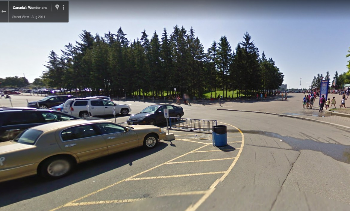
The only problem? The Street View was taken in 2011 and this particular spot is now consumed by supports for a giant roller coaster—a leviathan, if you will—that spills out into the parking lot:

wonderland-bike-rack-probably-not-here

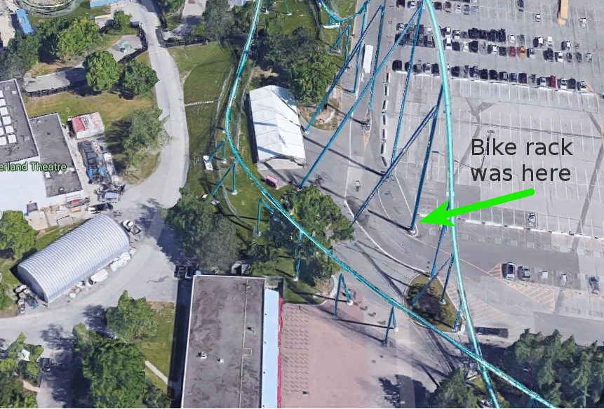
Huh. Maybe customer service was telling the truth. I mean, it didn’t look like the bike rack was all that well used in 2011, and if they put a support post right through the spot that hosted said rack, they may not have replaced it. But wait just a second! If you zoom in as far as you can, you can sort of see the faint outline of not one, but two bike racks between the support posts, each with a lonely bike hanging off it:

wonderland-bike-rack-maybe-here-after-all

All right, it looks like we’re back on! I loaded up directions in Google Maps, finessed it a bit for my preferences, and loaded this relatively direct yet incredibly twisty route into my GPS:

After all of the warnings from friends and family, after the assurance from customer service that I wouldn’t find a bike rack, and after the satellite-fuelled research, I set out on a sunny morning last week to meet my teammates at the theme parkconference center for our day of thrill ridesimportant meetings.

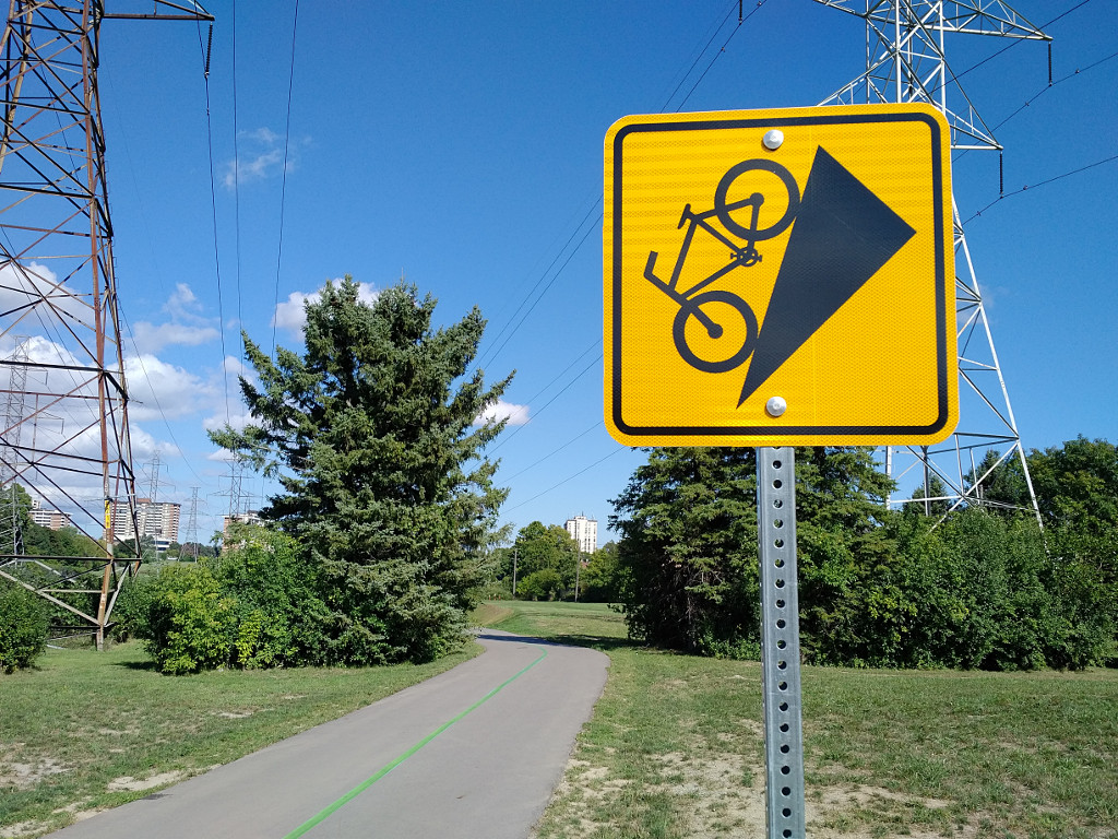
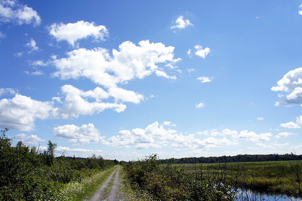
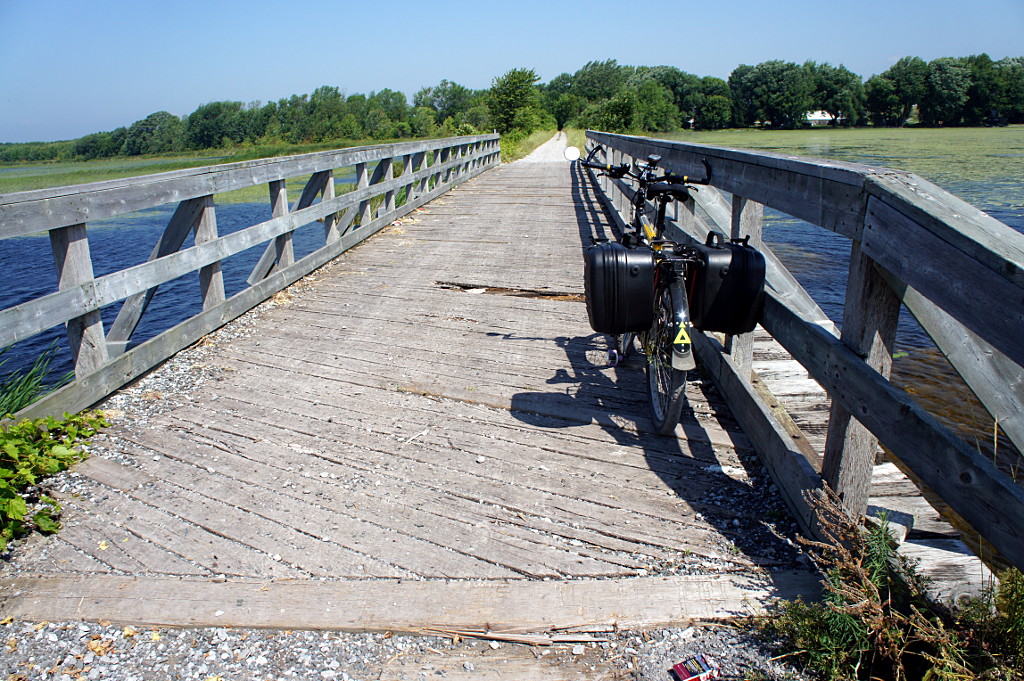
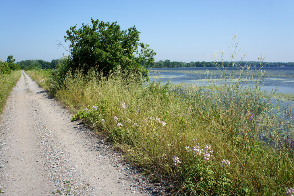
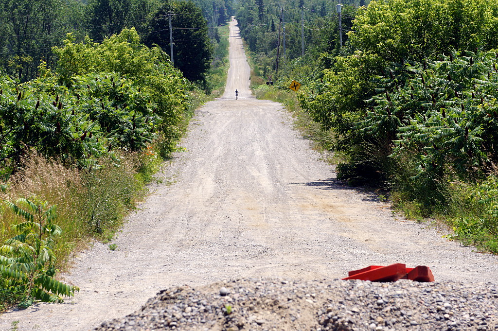
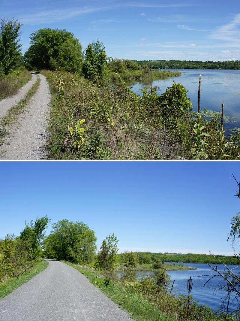
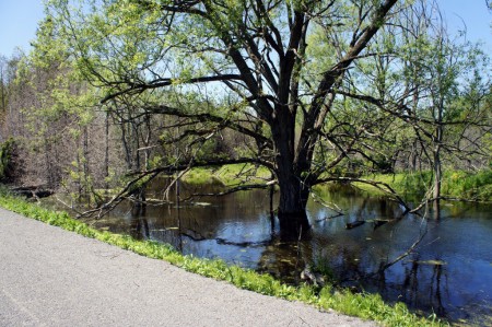
And you know what? The ride was actually really nice! A surprisingly large portion of the route north of the 401 is on trails through parks. By far the worst part was riding on Bayview between Lawrence and York Mills, a stretch of road I’m all too familiar with. Even the relatively short ride along car-friendly highway Rutherford Rd in Vaughan wasn’t bad in comparison. The only glitch I encountered was some construction that closed part of the bike trail, forcing me out onto Dufferin to get past the 407. There’s a beautiful bike lane on Dufferin north of Steeles that, sadly, ends just when it would be most useful: crossing the 407.

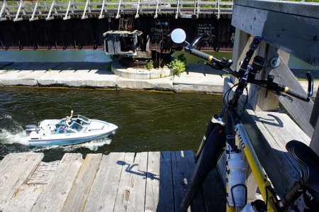
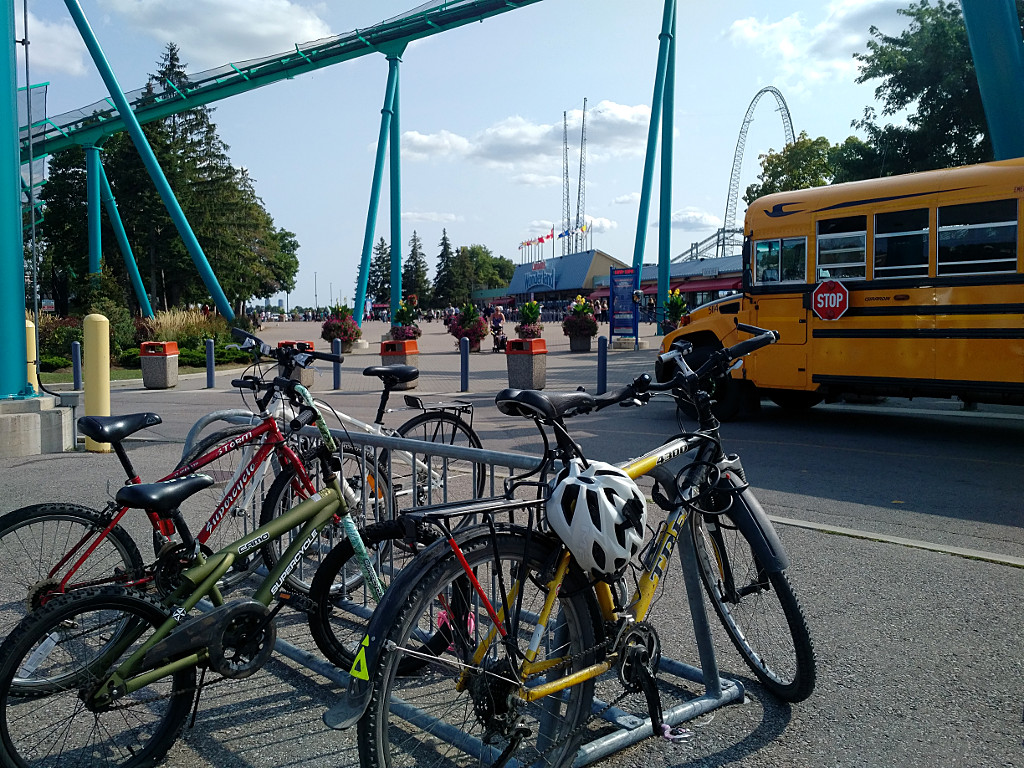
And so, less than two hours after setting out from Broadview & Danforth, I rode past Maple High School and into the parking lot at Canada’s Wonderland where the bike racks were exactly where Google Maps said they would be:

20170825-bikes-parked-at-canadas-wonderland

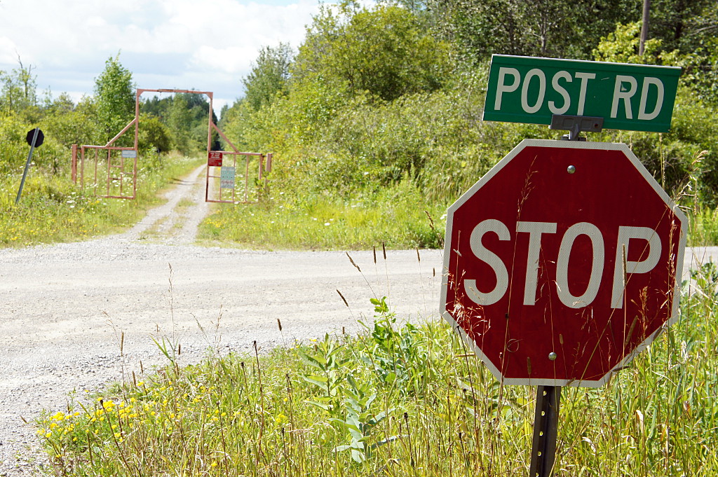
Would I do it again? Absolutely! It’s no worse than any other ride out of the city, and the joy of riding through a gargantuan parking lot to my—free!—parking right beside the entrance is always one of the joys of cycling to a destination. That said, the ride reinforced a long-standing problem with cycling infrastructure in and around Toronto: the optimum route is so hopelessly convoluted that you couldn’t hope to follow it without a good GPS and/or mapping app. If you want to get there in a car, you can just hop on the 400 and follow the signs; wouldn’t it be great if there was a signed route from the Finch hydro corridor to Canada’s Wonderland? The route is already there; now we just need the signs. Instead, you’re left cycling on a dead-end street, hoping that the GPS is right and there’s a trail at the end (there always was). Or assuming that the barely-visible gravel path beside the driveway actually goes somewhere (it did). As good as the ride was, it shouldn’t take so much effort to figure it out and keep track of it while you’re on the go.

Driving to work for Halloween

After considering a variety of costumes for my workplace Halloween celebrations (held on Friday last week), I decided to dress up as a car driver. I mean, what better costume could there be for a cyclist? I figured that it would be an easy enough costume to make and wear, given that drivers look (more or less) like normal people. For inspiration, my mind went to a time when driving was glamorous instead of a dehumanizing chore. I decided that I’d try to look like I was driving a roadster in the 1920s. It was still a pretty simple costume, requiring just an aviator’s hat, some goggles, and a long white scarf. This is what I came up with after poking around the closet for the scarf, Etsy for the hat, and Lee Valley Tools (of all places) for the insanely great goggles:

Val as old-time car driver

Val as old-time car driver

All that was left was the car. Now obviously, I don’t have an old roadster lying around, so I had to buy or make one that I could take to work for costume day. Oh, and did I mention that I wanted to make the 10 km commute by bike, the way that I always do? Three weeks, eight trips to Home Depot, three visits to Lee Valley, and two online orders later, this is what I ended up with:

Val's retro roadster

Val’s retro roadster


Here’s the full story.

Read More …

Steep (steep!) hill ahead

Along the Finch hydro corridor, these signs warn cyclists of an 80% grade hill coming up:

Bike on very steep hill sign

That’s one steep hill!

Wait a second, that can’t be right. That’s looks like they’re warning you that path goes straight down the face of the Scarborough Bluffs. But I just rode up this hill and I’m sure I would have remembered if it had actually been that steep. Let’s try a little head tilt:


2016-09-15-steep-hill-fixed2-1520120

Yeah, that’s more like it. Toronto signs, the latest in a continuing series.


New bike?

My new bikes?

My new rides?

That’s me in my new Quest velomobile, with my DF and Alleweder behind me. In my dreams, at least. In reality, I stopped by Bluevelo for a test ride in the Quest when I found myself in Collingwood last summer. And what a ride it was.

Bluevelo’s owner, Randy, accompanied me in the Alleweder as I piloted the Quest for an hour-long ride through the rolling countryside around Collingwood. Although I’ve lusted after the Quest for several years, it was my first time actually sitting in a velomobile. Indeed, it was my first time riding a recumbent. Hell, it was even my first time on a trike in nearly 40 years. And the Quest is a lot more sleek than the trike I used to power along East York sidewalks in the 1970s.

Randy and I set out on a warm sunny morning, first winding our way through local traffic and an industrial area before hitting the open roads just outside town. Riding a recumbent is all kinds of different from an upright bike. You grow accustomed to the sitting posture quickly enough, but leg muscles that are used to pushing down on pedals in a particular way take a little while longer to adapt to the legs-forward position. I thought my legs were going to fall off when we rounded the first corner, barely a couple of minutes into the ride. But it got better from there.

Coming from the world of upright two-wheelers, I quickly encountered a few things that required getting used to:

  • The steering felt a lot more twitchy than I’m used to. I’m sure it’s just a matter of getting used to the steering tiller and using two front wheels instead of leaning to control my direction. I was already riding more smoothly by the end of my hour-long ride so the twitchiness would probably be gone entirely after a couple of days of regular riding.
  • It’s heavy. No amount of aerodynamic fairing will help you climb a hill. I’m used to pulling a heavy trailer up all kinds of hills on loaded tours and I found the Quest’s 70-pound frame to offer a comparable experience. On the upside, you can go as slowly as you need to because you don’t need to maintain your balance. Feeling the weight on uphills and when starting from a dead stop would be a bit of a culture shock to a roadie.
  • Chain slap. Shifting gears at speed sometimes resulted in big waves traversing the length of that long chain from the crankset at the front to the cassette all the way at the back. I’m used to making soft shifts on my upright bikes by easing off the pedals a bit when I hit the shifter but found that I had to be much more conscious about the technique in the Quest. Again, I’m sure that it becomes second nature once you’ve ridden it for a few days.

And that was basically it; I’d catalogued all of the negatives and idiosyncrasies within a couple of minutes of pedalling away from the shop. The rest of the hour was spent marvelling at the wonders of the Quest. Although the weight makes it slower to accelerate, the full fairing and low-to-the-ground posture mean that once you’re going, you can keep going with little effort or really fly with just a little more. And fly I did. I never did much more than turn my legs at a steady pace but ended up with an average speed slightly higher than I would have gotten if I’d done the same route all-out on my road bike. The aerodynamic shape is incredibly good at maintaining speed when you coast. And I coast a lot.

Going up hills was undeniably more difficult in the Quest than on a road or mountain bike, but it was far easier to maintain higher and more consistent speeds on the flats. As for downhills, they’re ridiculous amounts of fun: push a bit at the top and you feel like you’re going to take off by the time you get to the bottom. If you get going fast enough, the inertia can take you over the next roller so quickly that you don’t even notice you’re climbing.

I could definitely get used to taking the Quest for a spin through the countryside. Which raises the question…no, I haven’t bought one. Yet. I spent a full two hours at Bluevelo that day and the pitch is compelling. I went in expecting (maybe even hoping) to find some kind of deal killer but every time I said, “Yeah, but what about <X>?” Randy had a great explanation. I’m probably not going to buy one this year, but I can definitely see one in my mirror, slowly reeling me in. The only question is whether a velomobile will be my next city bike or my next touring bike.


Lindsay to Bethany rail trail

A wetland view from the Lindsay to Bethany rail trail.

A wetland view from the Lindsay to Bethany rail trail.

Continuing my exploration of the many rail trails in the Greater East Dodgeville Area, I rode the Lindsay-Bethany trail last month. The trail runs southeast from Lindsay to Bethany and is the southernmost section of the Victoria Rail Trail, which runs all the way up to Haliburton. Like most trails in the area, the surface is highly variable, sometimes changing between loose gravel, sand, mud, grass, and crushed gravel all in the course of a few hundred metres. At the very southern end past Bethany, a portion of the trail has perfectly spaced and sized depressions; it feels like riding a mini pump track and is way more fun than you’d expect riding on a straight rail trail would be. Most of the trail is hard-packed double track that’s easy enough to ride on, but you do have to be ready for the occasional potholes and surface changes that come with a trail that isn’t quite up to Trans Canada Trail standards like the Omemee and Hastings trails are. I seem to say this of a lot of trails, but I wouldn’t recommend it for hybrids or road bikes. It’s quite acceptable on a decent mountain bike, with or without front suspension. Of all the trails I’ve been on recently, it’s also the most heavily used by ATVs: I encountered close to a dozen of them in the first few kilometres riding out of Lindsay on a sunny Sunday afternoon, though there were none on the last half of the trail to Bethany.

You always know where you are on the Lindsay-Bethany trail

You always know where you are on the Lindsay-Bethany trail

One thing does set the Bethany trail apart from all of the other trails I’ve been on recently: it feels very isolated. While most other trails pass behind backyards and farm fields, the Bethany trail spends a lot of time skirting large wetlands and valley forests while the Pigeon River and Fleetwood Creek meander back and forth with no farm fields or houses anywhere in sight. Even road crossings become rare on the southern half of the trail, making the whole experience feel more wild and natural than other trails, even knowing that the farms and quarries are still there, just a little out of sight.

Another rare sight is clearly visible at every intersection where the trail crosses a road: signs! No, not the stop signs, but honest-to-goodness street signs. It’s the first trail I’ve been on where every intersection is marked so that you don’t have to guess which road you’re crossing. It’s a wonder that more trails don’t have this simple nod to the fact that people may want to know where they are.

Read on for the ride gallery.

Read More …

Kingston to Cobourg, Day 2: Blow the man down!

The Millennium Trail in Prince Edward County.

The Millennium Trail in Prince Edward County.

Nothing gets you going in the morning like a hearty French toast breakfast, and Magnolia Meadows host Isabelle didn’t disappoint. An hour after polishing off a stack of French toast, a pot of tea, and a glass of juice, I was ready to hit the road again on Day 2 of my mid-July ride from Kingston to East Dodgeville. It was just a bit cooler than it had been the previous day, but still uncomfortably hot as I got underway shortly after 10 a.m. But the killer this day wasn’t the heat or the humidity; it was the wind. Blowing briskly from the west at a steady 40 km/h (and gusting to 60 km/h), Old Man Wind’r would be my nemesis for the next few hours as my route took me straight into his gaping maw.

The Friday ride was to start with a short stretch along the main rail trail in Prince Edward County, the Millennium Trail, before moving onto local roads for the majority of the ride into Cobourg. I joined the trail a short distance north of the B&B. I’ve shared trails with dirt bikes, ATVs, and even full-sized touring motorcycles, but this was the first time I’ve ever had to share a rail trail with golf carts: in Wellington, the trail goes through a golf course and carts zip onto the trail for short distances to get to the next hole. Fortunately, it only takes a couple of minutes to get past the course and I only saw a couple of carts.

A causeway carries the Millennium Trail across a lake.

A causeway carries the Millennium Trail across Consecon Lake. I hope there’s a bridge at the far end.

This day’s route called for me to stay on the rail trail for 3-4 km and then venture back onto the roads for the rest of the day. But with the open road came my first taste of the headwind that would bedevil me for the rest of the day. After a few minutes, I scurried back to the trail and the sheltering vegetation lining both sides and keeping the wind to a minimum. Although the trail surface varied from smooth limestone dust to sandy double track and large gravel, it was far easier to maintain a good pace on the rail trail than to battle the wind.

Being beaten back to the trail turned out to be a blessing in disguise because the Millennium Trail was easily the best part of the ride on either day. The wind was controlled, the scenery beautiful, and the trail was wholly deserted: I didn’t encounter a single person on the trail after I passed the golf course on my way out of Wellington.

The only problem: at one point, my GPS and my printed Google maps disagreed over whether the trail continued across a bridge over Consecon Lake up ahead. Should I keep going on the trail or return to the road grid to get around this potential dead end? I decided that I’d rather have to double back on the trail than ride on the road if I didn’t absolutely need to, so up the trail I went. In the end, Google was right: the trail followed a causeway out across Consecon Lake and an old bridge did indeed span the gap that my GPS showed. And the bridge was a little more confidence inspiring than it was in 2004.

Most of the Millennium Trail isn’t in good enough condition for casual cyclists on hybrid or city bikes, but it’s a easily ridable on anything with wider tires. It was a pleasure to ride on a front-suspension mountain bike, but rigid forks and well-padded gloves would have done just as well. The entire trail northwest from Wellington is a great ride. Next time, I’ll ride it all the way from the eastern end of the County in Picton. But all good rail trails must come to an end and I rejoined the road to cross the western end of the Murray Canal outside Brighton. Away from the busy Loyalist Parkway, the crossing at this end of the canal is much quieter and allows you to skirt Brighton rather than going through the town on major streets. Highly recommended for all cyclists riding between Wellingon and Presqu’ile. Unfortunately on this day, with the open road came the fierce wind and the afternoon heat, kilometre by kilometre sapping my will to ride.

Lone jogger on a hot road

From the closed bridge on Barnes Road, a lone jogger plods down the deserted and very hot road.

I rode through the south end of Brighton, past Presqu’ile Provincial Park and toward Cobourg, my target for the day. I wanted to stick as close to the lake for as long as possible before joining the main road to Cobourg, so I took a chance when I saw a “bridge closed” sign directing me up to the highway as a detour. It meant I’d be rolling the dice for a second time in one day on a potentially non-existent bridge, but what the hell; at least I’d have a tailwind for a few minutes if I had to backtrack. Two and a half kilometres after the sign, a gravel barrier blocked vehicular access to the railway overpass on Barnes Road, but it was obviously still well-used by pedestrians. I hefted my bike over the pile of gravel and sat down for lunch on the bridge, just a few hundred metres short of the road to Cobourg.

At this point, it was clear that finishing the ride all the way to Cobourg would be a serious challenge. Although this day’s ride was planned to be around 25 km shorter than the previous day’s, the wind was taking so much out of me that it might as well have been 50 km longer. As I turned onto the main road west to Cobourg and back into the full-on headwind, I knew I was defeated. I slogged through Salem, Colborne, and Wicklow before finally succumbing to the heat and wind at Grafton, calling Risa to pick me up about 15 km short of our planned meeting place in downtown Cobourg. By that time, my pace had been slowing down so steadily that my GPS had been declaring Cobourg to be just an hour away for the previous 45 minutes.

I’d definitely do the entire ride again if I had the chance, but I’d order up cooler weather and a much lighter breeze next time. And barring that, I’d head east with the wind, rather than west into it. That said, I highly recommend the entire route I took. I’d make more detours with more time and more bike-friendly weather, but the route was an excellent combination of being away from traffic on backroads and quiet trails, together with scenic highways when necessary. If I’d been on a road bike, I would have had to stick a little closer to civilization for most of the second day. It’s one reason that I like doing tours on my mountain bike: it can be a bit more challenging if I’m just riding along paved roads, but it gives me a lot more freedom when it comes to selecting a route and making detours along the way.

I bracketed this ride with a bus trip to Kingston and a car pickup in Cobourg, but the trip could just as easily have started with a train ride to Kingston and ended at the Cobourg VIA station for a ride back to Toronto. Or add an overnight stay in Cobourg and a third day of riding to the GO bus in Newcastle or GO train in Oshawa.

The gallery from the ride is below the fold.


Read More …

Peterborough to Hastings rail trail II: New and improved

The Lang-Hastings Rail Trail before and after its makeover.

The Lang-Hastings Rail Trail before and after its makeover.

What a difference a year makes! I first cycled the Peterborough to Hastings rail trail last August, saying at the time that the trail was “challenging” because of the relative lack of summer maintenance. Back then, the trail was rough, somewhat overgrown, and best suited to a mountain bike with at least front suspension. At that time, a plan was afoot to improve the trail and elevate it from a “proposed” route for the Trans Canada Trail to being an official part of the cross-country walking and cycling path. Well, the trail got its promised upgrades last autumn and spring, was officially named the Lang-Hastings Trans Canada Trail, and is now an absolute pleasure to ride on.

peterborough-hastings-rail-trail-2013-3946

A beaver pond along the Lang-Hastings trail.

The trail starts at the southeastern edge of Peterborough and meanders east toward Hastings on the Trent River. Like most rail trails, it’s quite flat, with long gentle grades rather than hill climbs. It passes behind farm fields, beside quiet country roads, next to wetlands,  and between hills.

The new crushed limestone surface brings the Lang-Hastings trail up to the same quality as the Omemee trail to the west and is a vast improvement over the rutted and loose gravel double track I rode last summer. With a better trail comes more traffic: instead of cycling for 90 minutes without seeing another soul as I did last year, I encountered at least two dozen people riding the trail on a sunny Sunday afternoon in May.  There were even a couple of spandex-clad roadies enjoying the smooth ride.

peterborough-hastings-rail-trail-2013-4054

The trail ends at an open swing bridge over the Trent River

The trail head is a little awkward to access from the Peterborough end, where it doesn’t quite match up yet with the rest of the Trans Canada Trail to the northwest. Don’t make the mistake of trying to join the trail from Technology Drive in Peterborough; the trail there is wholly unimproved and still has rails and ties for about the first kilometre. Your best bet is to join the trail at Keene Road, a short distance outside Peterborough. There’s some roadside parking available there, or you can make the relatively quick ride from downtown with only a short section along a busy Highway 7 / Lansdowne Avenue.

Between Peterborough and Hastings, the rail trail has the expected mix of farm fields, wetlands, and very gentle climbs and descents. There are a few surprises along the way, including a pond created by an impressively long beaver dam that abuts the trail. After riding thirty-some kilometres east to Hastings, the trail ends rather abruptly at an open swing bridge over the Trent River, requiring a rather lengthy detour to pick up the TC Trail again on the other side of town. You’re best off bailing from the trail at 7th Line and riding into town along River Road and Park Lane. (Hint: take Park Lane, even though it looks kind of silly to do so on a map.)

Although I wish the connections at either end were more direct, I’m happy to have the Lang-Hastings trail brought up to standard. With more users will come greater pressure for connectivity and improvements for other trails, and that can only be good. Peterborough is at the centre of a network of trails that stretches from Uxbridge and Lindsay in the east, to Haliburton and Bancroft in the north, Prince Edward County in the south, and Renfrew in the east. As the gaps in existing trails are filled in and more of them are improved to be suitable for casual cyclists, you could be looking at the backbone of Ontario’s own Route Verte-alike cycling network.

Continue reading below the fold for a short gallery from along the trail, and compare it to last year’s ride along the same route.

Read More …

Road turkey

Road-running turkey

Near Millbrook, two domestic turkeys were foraging at the side of the road when I cycled by. One ran straight back into its field while this one ran up the road to the driveway and then ran up the driveway to the barn. Neither one took any notice of the car that passed by a few seconds earlier. So why did the turkey cross the road? To get away from the cyclist.

Major malfunction

Cyclist caution sign

Not only does this cyclist exhibit some seriously flawed technique, but he’s suffering a major mechanical malfunction too: those shattered rods flying in front of him must be the missing top tube and chainstays from his bike. The perils of crappy carbon frames.

Also, I notice that Mr. Stickman is carrying a few extra pounds:

Mr. Stickman is a little out of shape

Poor Mr. Stickman. He’s out for his first (and likely only) spin around the block this year, just trying to work off his winter fifteen and disaster strikes! I’m not even going to try to figure out what happened to his feet.