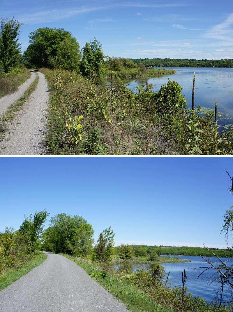
The Lang-Hastings Rail Trail before and after its makeover.
What a difference a year makes! I first cycled the Peterborough to Hastings rail trail last August, saying at the time that the trail was “challenging” because of the relative lack of summer maintenance. Back then, the trail was rough, somewhat overgrown, and best suited to a mountain bike with at least front suspension. At that time, a plan was afoot to improve the trail and elevate it from a “proposed” route for the Trans Canada Trail to being an official part of the cross-country walking and cycling path. Well, the trail got its promised upgrades last autumn and spring, was officially named the Lang-Hastings Trans Canada Trail, and is now an absolute pleasure to ride on.
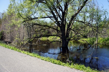
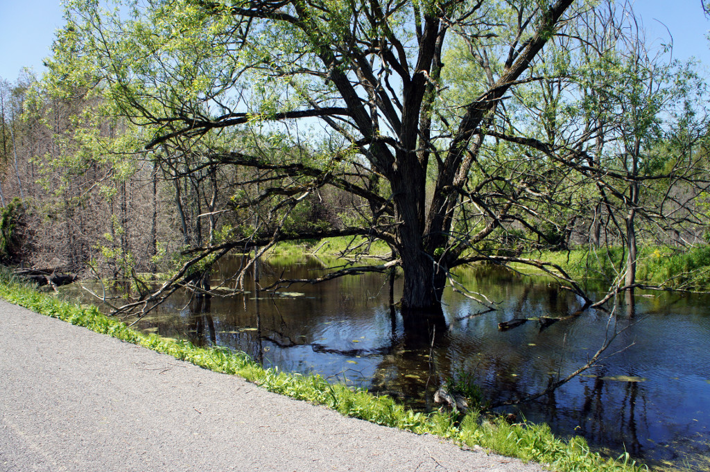
A beaver pond along the Lang-Hastings trail.
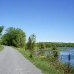
The trail starts at the southeastern edge of Peterborough and meanders east toward Hastings on the Trent River. Like most rail trails, it’s quite flat, with long gentle grades rather than hill climbs. It passes behind farm fields, beside quiet country roads, next to wetlands, and between hills.
The new crushed limestone surface brings the Lang-Hastings trail up to the same quality as the Omemee trail to the west and is a vast improvement over the rutted and loose gravel double track I rode last summer. With a better trail comes more traffic: instead of cycling for 90 minutes without seeing another soul as I did last year, I encountered at least two dozen people riding the trail on a sunny Sunday afternoon in May. There were even a couple of spandex-clad roadies enjoying the smooth ride.
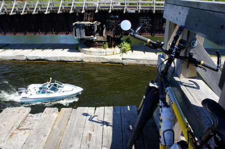
The trail ends at an open swing bridge over the Trent River
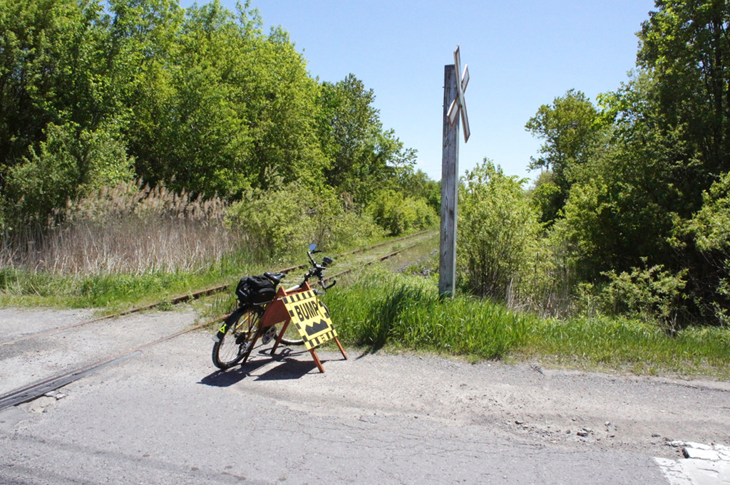
The trail head is a little awkward to access from the Peterborough end, where it doesn’t quite match up yet with the rest of the Trans Canada Trail to the northwest. Don’t make the mistake of trying to join the trail from Technology Drive in Peterborough; the trail there is wholly unimproved and still has rails and ties for about the first kilometre. Your best bet is to join the trail at Keene Road, a short distance outside Peterborough. There’s some roadside parking available there, or you can make the relatively quick ride from downtown with only a short section along a busy Highway 7 / Lansdowne Avenue.
Between Peterborough and Hastings, the rail trail has the expected mix of farm fields, wetlands, and very gentle climbs and descents. There are a few surprises along the way, including a pond created by an impressively long beaver dam that abuts the trail. After riding thirty-some kilometres east to Hastings, the trail ends rather abruptly at an open swing bridge over the Trent River, requiring a rather lengthy detour to pick up the TC Trail again on the other side of town. You’re best off bailing from the trail at 7th Line and riding into town along River Road and Park Lane. (Hint: take Park Lane, even though it looks kind of silly to do so on a map.)
Although I wish the connections at either end were more direct, I’m happy to have the Lang-Hastings trail brought up to standard. With more users will come greater pressure for connectivity and improvements for other trails, and that can only be good. Peterborough is at the centre of a network of trails that stretches from Uxbridge and Lindsay in the east, to Haliburton and Bancroft in the north, Prince Edward County in the south, and Renfrew in the east. As the gaps in existing trails are filled in and more of them are improved to be suitable for casual cyclists, you could be looking at the backbone of Ontario’s own Route Verte-alike cycling network.
Continue reading below the fold for a short gallery from along the trail, and compare it to last year’s ride along the same route.
-
- The trail looks a little rough at Technology Drive in Peterborough, about a kilometre west of where the improved trail starts.
-
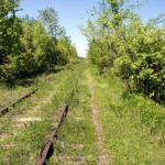
- A rocky and rutted single track runs alongside the unused tracks for the first kilometre or so from Technology Drive.

-
- About 1 kilometre west of Keene Road, the improved trail takes over.
-
- Looking back from the new trail to the old.
-
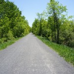
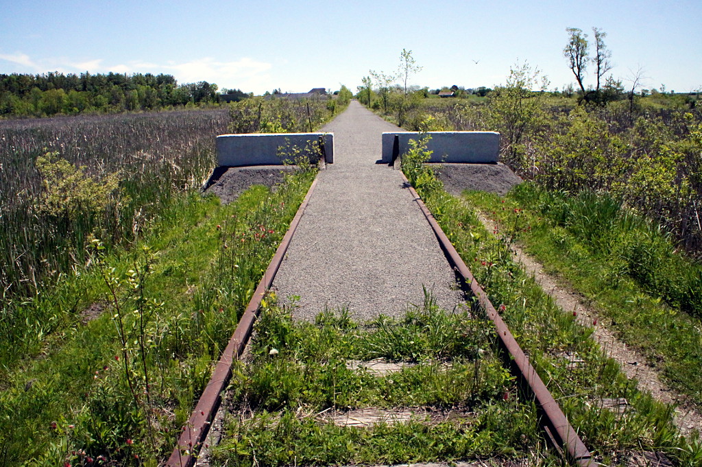
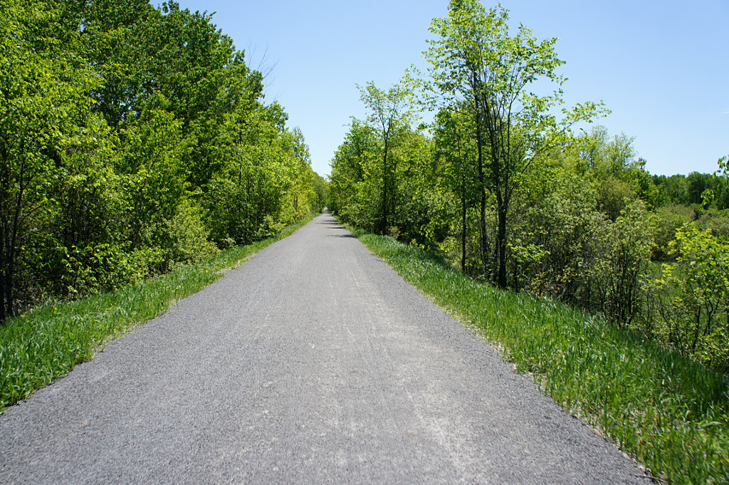
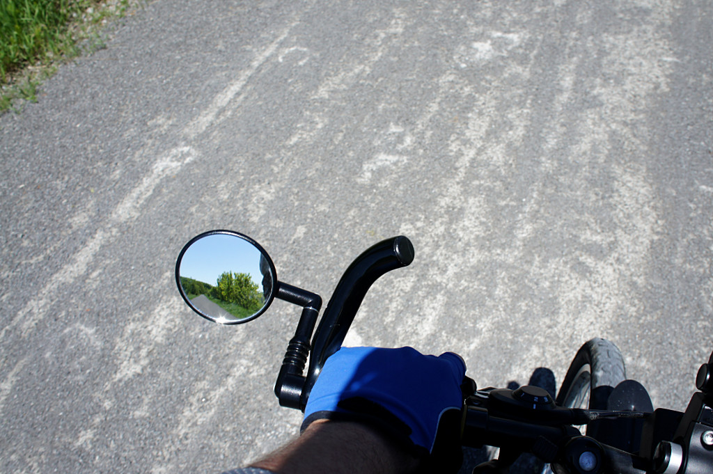
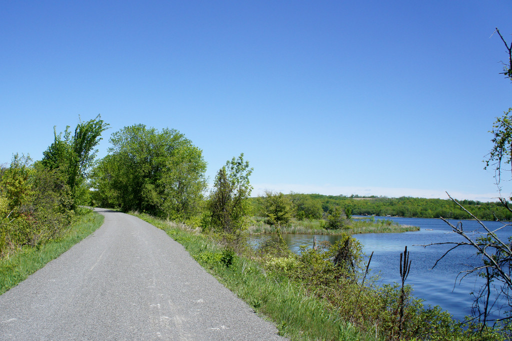
- The trail is smooth and flat, with gentle grades and curves along the entire length.
-
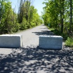
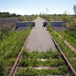
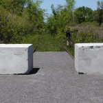
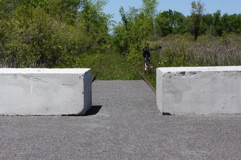
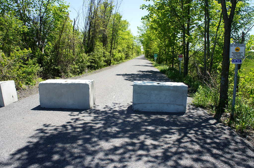
- Farmers must drive some farm equipment across the trail in many areas, and large concrete barriers have been placed in those sections to prevent vehicular incursions onto the trail.
-
- Looking back.
-
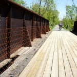
- All of the bridges along the trail have been redecked. Some were in really poor condition before this project, as you can see by the original decking on this bridge, still visible behind the screen on the left.
Also new this year, other cyclists! I barely saw another soul during last year's ride, but saw quite a few cyclists on this year's.

-
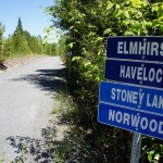
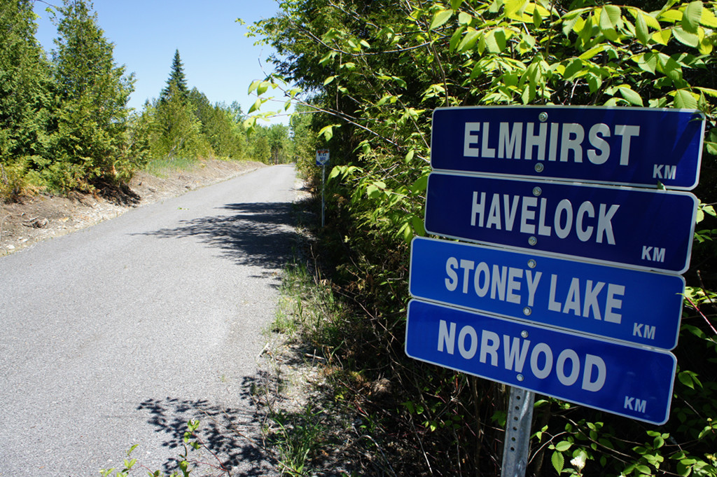
- The destination signs (still sans mileage) are meant for the snowmobiles that use the trail system in the winter, but hint at some of the possibilities for improvements to the cycling network.
-
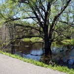
- A beaver pond is right beside the trail.
-
- The trail comes up to the Trent River outside Hastings before curving away again.
-
- In Hastings, the trail ends at an open swing bridge over the Trent River. The bridge closes to allow snowmobile traffic across the river in the winter.

Excellent! I’m interested in trying this trail later August, perhaps going all the way to Belleville with an overnight stay in Peterborough. (However, I found out that the Madoc Junction-to-Foxboro trail is owned by a trust that requires a permit even for cyclists – and that it dirt bikers and ATVs use this trail.
Three weeks ago, I biked from Barrie to Midland and back using rail trails, connecting between the two in Orillia. The entire section between Highway 400 and Midland in Tay Township is paved and popular with local cyclists and pedestrians, and the Oro-Medonte trail between Barrie and Orillia is relatively well-used, but the Uhthoff trail was nearly deserted. I passed two cyclists on my way back to Barrie southeast of Coldwater; on the way up I encountered only motorized bikes: one Scooter-style e-bike and two (illegal) dirt bikes. A recent extension connected Coldwater with the paved Tay Shores trail at Waubaushine.
That would be a good ride. I can’t vouch for the trail from Hastings, but my guess is that it’s a lot like this one was last year: highly variable. If you’re going as far as Belleville and can spare another day or two to ride, I highly recommend heading into Prince Edward County.