Well, I did it. As I’d threatened to do earlier this year, and just four weeks after reiterating my vow, I rode back home to Toronto after taking the Bike Train to Niagara Falls.
As on my previous Bike Train adventure with Risa, the ride to Niagara was a joy. We were a little late leaving Union Station and about 45 minutes late arriving at Niagara Falls, but it was still better than driving. Especially when I looked out the window between naps and saw the stop-and-go traffic on the QEW.
From my perspective as a two-time rider, the Bike Train has been a resounding success. VIA Rail and the other partners are seriously stupid if they don’t expand the program next year, running more frequently and to more destinations. And don’t make Bike Train founder Justin Lafontaine load and unload the bikes at Niagara Falls any more!
Ride Details
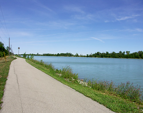
I’d originally planned to ride from the Niagara Falls train station to Niagara-on-the-Lake and follow the Waterfront Trail from the very beginning back to Toronto. But I decided earlier this week to cycle west to the Welland Canal and ride down the Welland Canal Trail to Port Weller before continuing along the Waterfront Trail to Toronto. Taking this road less travelled taught me three things:
- Don’t rely on a Garmin eTrex Vista Cx handheld GPS to properly auto-route for a bike. Although it offers “bicycle” as a vehicle choice (which will cause the auto-routing algorithm to avoid highways), it outright refused to show me a reasonable route taking me the 25 km from Niagara Falls to Port Weller. Instead, it insisted that I go the other way, heading into the U.S. before completely circumnavigating Lake Ontario twice on a 1660 km odyssey. Uh, I don’t think so. Just to make the annoyance complete, the Vista happily directed me straight down the QEW for 15 minutes when I set the vehicle type to “car.” Fortunately, I’d already planned my route and was able to follow the waypoints I’d set. I also had paper maps with me. Never rely solely on GPS in unfamiliar territory.
- Signage outside the tourist areas in Niagara Region really sucks. Several times I blew past a planned turn and had to backtrack because there were no street signs at intersections. I’m not talking about minor dirt paths here either, I’m talking about major 4-lane regional roads. I eventually gave up and settled for heading in the general direction of my destination along whatever road I happened to be on.
- Don’t be fooled by the Niagara Region Bicycling Map‘s assurance of roads with bike lanes or paved shoulders. While there are many nice riding trails throughout the region, too many of the so-called bike lanes on roads between the Falls and the Welland Canal are barely more than a sewer grate wide. Most of them are not signed as bike lanes, although that’s clearly their intended use. That said, traffic here was far less of a problem than on an average afternoon in Toronto.
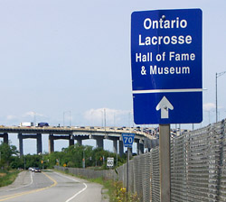 Although Niagara doesn’t seem to sign many of the local streets, they take great pains to provide wayfinding signs for some of the local attractions, including this pointer to the Ontario Lacrosse Hall of Fame & Museum. Inductees include such Ontario lacrosse celebrities as veteran player Chuck Baldwin, the infamous Elmer “Milkshake” Lee, the colourfully-nicknamed James “Jim” Wasson, and the genuinely famous Jay Silverheels (best known as Tonto on TV’s The Lone Ranger). What the sign doesn’t say is that the Hall is in the same building as the slightly more touristy St. Catharines Museum at Lock 3 on the Welland Canal. Whether you’re there to brush up on lacrosse history or to see some big lakers up close, you’ve come to the right spot.
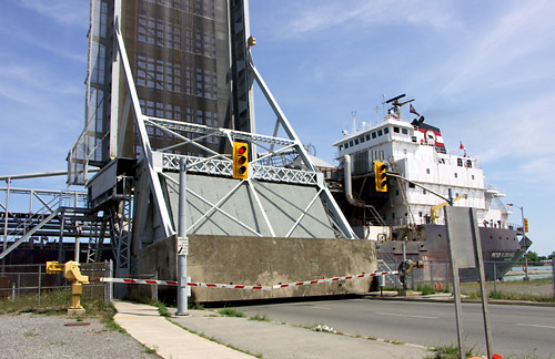
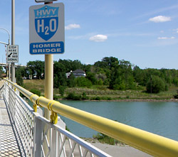
Keeping up with these eco-conscious times, the St. Lawrence Seaway has rebranded itself Highway H2O, an environmentally-friendly alternative to shipping by truck or rail. I’m all for it. Many people, especially tourists, probably see the Welland Canal and its ilk as being quaint relics from our distant past, not as thriving commercial highways, which is what they really are. Within Ontario, the perception is probably boosted by the primarily recreational use of our best-known canals, the Trent-Severn and the Rideau. But when you see one of those lakers passing by close enough for you to chat with the crew without raising your voice, you realize that this is still very much a working waterway.
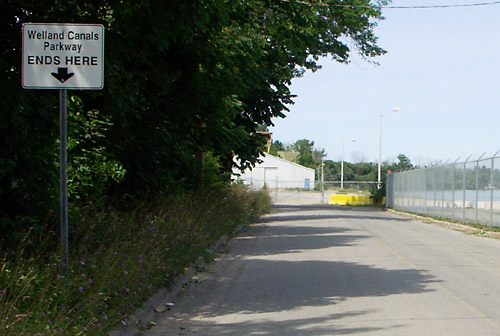
My ride along the canal to the Waterfront Trail ended unceremoniously with the termination of the Welland Canals Parkway in the parking lot of the Port Weller sewage treatment plant. I knew I should have taken that left turn at Albuquerque. I rode back up the hill and saw that I had indeed missed the obvious connection to the Waterfront Trail:
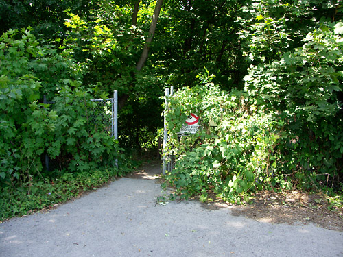
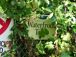 What do you mean you can’t see the sign? It’s right there, hidden behind a year’s worth of natural regeneration. Little did I know that this was as good as the Waterfront Trail signage would get in Niagara Region. Just one minute away from this sign, another outright lies about where the trail goes. If you follow the sign, you end up right back in the parking lot where the Welland Canals Parkway ends. Upon seeing the sign pointing to your left, the proper course of action is to turn completely around and go back the way you came, following yet another trail out of the woods. Good to see that Toronto isn’t the only place with wayfinding issues.
Toronto is also not alone in having a public works department with, shall we say, somewhat lax standards, as this speed bump in Port Weller shows:
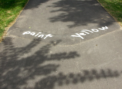
The funny thing is that it probably took longer to paint “paint yellow” on this speed bump than it would have taken to actually paint it yellow. That said, I wasn’t sure whether this was an official field notice from one employee to another or a local protest against the lack of warnings on the speed bump. Either way, it almost certainly would have been simpler to haul out a bucket of yellow paint.
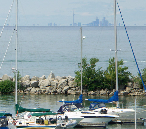
In Port Dalhousie, I noticed the emerald city beckoning from across the lake like a hazy mirage across an impassable desert. My house was only 53 km away from here as the crow flies, but I still needed to ride pretty far west before I could turn the corner to go north and then finally east. By the time I’d reached this point, and after at least a dozen missed turns, I’d all but given up trying to follow the Waterfront Trail and headed out of town on the most direct route possible.
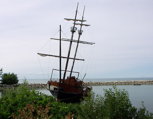
Just outside Jordan Harbour lies the infamous pirate ship visible from the QEW. Destroyed by fire five years ago, it used to be an explorer’s dream.
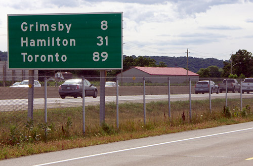
Having already ridden over 70 km, I found this sign a little discouraging. It’s not that I wasn’t expecting a long ride when I set out, but that I didn’t expect giant highway countdown signs taunting me along the way.
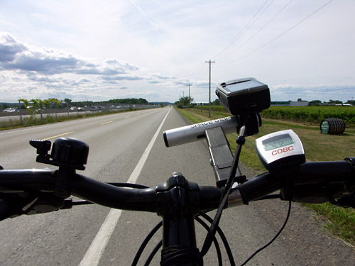
Most of the Waterfront Trail between St. Catharines and Hamilton runs along the QEW’s relatively quiet North Service Road. It’s nice enough as a direct, fast cycling route, and long stretches have wide bike lanes or paved shoulders. But after a while, riding beside the QEW gets boring. The whole point of riding out here is to escape the cars and the traffic, yet Ontario’s original superhighway was just a chainlink fence away for almost two hours.
Much of this part of the ride is a study in contrasts: industry and six lanes of high speed traffic on the left, farms and vinyards on the right. But even out here, suburban sprawl is quickly encroaching on prime agricultural land.
By the time I reached Hamilton Beach under the Burlington Skyway around 6 p.m., the sun was getting low and I was more concerned with getting home at a reasonable hour than I was with taking pictures. You’ll have to take my word that the Waterfront Trail through Hamilton and part of Burlington is a beautiful ride thorugh interesting parks with wide trails. I rode straight along Lakeshore Road through most of Burlington, Oakville, and Mississauga, hoping to make up some lost time and distance by not taking any of the offroad detours suggested by the trail. Maybe another day.
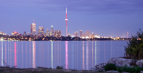
I continued along Lake Shore Blvd well into Etobicoke, ducking down to the Martin Goodman Trail near Humber Bay around 9 o’clock. The skyline (complete with pimped CN Tower) looked so welcoming (and so close, compared to the picture I’d taken six hours earlier) that I couldn’t resist climbing off the bike for one last shot.
I arrived home about an hour later, sore but satisfied. Saturday’s ride was a whopping 169 km, which makes it my first non-metric century and longest ride ever by over 40 km. In total, I was in the saddle for more than seven and a half hours over the course of nine hours on the clock. Two meal breaks, three snack breaks, a whole lot of picture breaks, and thirteen hours after leaving home for Union Station that morning, my adventure was complete. It’s not quite the 300 km rides that others are chasing this summer, but it’s more than enough for me and my trusty mountain bike.
Excuse me for asking but how old / young are you?
Many decades ago taking my bike out for a long day of riding was the natural thing to do. My two sons 19 and 22 now put me to shame. I may start on some round trips between Niagara Falls, NY and St. Catherins (Wellend Canal) before I try the NY to GTA.
What do you think?
Love your blog by the way.
Pictures are alwyas worth their weight in Buffalo Chips when you are trying to effect change.
This Saturday I will stick with the GO train. Plenty green and not much risk of a cardiac catastrophe somewhere in wine country. Thanks for blazing the trail for the rest of us. If not for me then my sons.
My experience is that it’s best to do loop rides in somewhat familiar territory before undertaking a long one-way ride. In this case, I wasn’t even sure when I set out that I’d make it all the way home. I did know that the 120ish km to Oakville—where I could have caught the train the rest of the way home if necessary—was well within my established range for this year. I wouldn’t have attempted the ride without some kind of backup plan.
I quite liked the Welland Canal route, and recommend it. The portion of the trail I rode along was remarkably deserted for such a beautiful Saturday afternoon. If you ride along the canal, take a break at the museums at Lock 3.
At 37, I ride farther, faster, and more often than when I was 15 years lighter and 25 pounds younger.
Hi,
Thanks for your documenting your trip. It makes for an interesting read. I live in the Ottawa area and am hoping the bike-train service will be offered here at some point. I’m not sure what the plans are for expansion , but I’ll stay tuned.
This is a service that’s long overdue!
And it doesn’t take much when you consider how much space is available on trains.
Bike Train riders were asked to fill out a survey which included a question about future expansion. One of the potential routes mentioned was Toronto-Kingston-Ottawa, so service to Ottawa does seem to be likely if the program expands in future years.
I think that the success of the Bike Train’s limited run this summer proved that there is a great deal of pent-up demand. I’m sure that everyone involved will be crunching the numbers for the next few months and we can all hope that they’ll come up with an expanded program for next year.
Sounds promising. Thanks for the info.
I can understand why it’s been so successful. It makes sense in so many ways.
What I can’t understand is why it’s taken so long to do something as simple as take a bike on a train. As far as I’m concerned, this is something that should be possible on just about any train route.
I agree wholeheartedly. There’s really no reason why you shouldn’t be able to roll on and roll off of any train in the country. As I said following my first ride on the Bike Train, it’s a sad commentary that we get so excited about something as simple as taking our bikes somewhere without a car.
Yes, unfortunately things are really set up for people with cars. Bus services can be really poor too unless you’re traveling to major destinations.
So there are a lot of places you just can’t get to without a car.
Often biking the whole distance is a major undertaking. But being able to cycle just part of the way really opens up possibilities for travel.
I use the Rack & Roll service here in Ottawa (bike + public transit) quite a bit. It’s a great way to get around the city and I wouldn’t be able to use my bike nearly as much without it. This too is a fairly recent service. Now if they would only extend the season a little!
Perhaps you should have purchased both “‘Round Lake Erie: A Bicyclist’s Tour Guide, 2nd Ed.” and “‘Round Lake Ontario: A Bicyclist’s Tour Guide, 3rd Ed. (2008).
“‘Round Lake Erie…” & ‘”Round Lake Ontario…” have the complete “Merritt Trail”/Welland Canal bicycle route in it. I rode the route and drew the maps.
I’ll even send you the maps via the internet. The maps are for your personal use not for publication on the internet.
Email me with a clear subject line.
Yours,
Harvey Botzman
the author
Last year, my girlfriend and I rode our bikes in the opposite direction, from T.O. to N.O.T.L. and then back again. We’re in better shape now than we were then, (i.e: it took us much longer than a day to do the trip, and getting back we were even more tired!) But we found much the same as yourself that the N. Service Rd right beside the QEW was a pretty boring, and so was Oakville. However, the Hamilton Beach Rd ride was a lot of fun, and pretty much makes it worth the trip. I don’t know that there are any maps that are particularly better than the waterfront trail map and the one provided by the Niagara Biketrain people.
However, this year, thanks to the Biketrain, we did get a chance to do the Niagara Loop and go down the Welland Canal path, which, as you mentioned is a great route with almost no car traffic. The most scenic part of the trip, however, is definitely the path along the Niagara River.
Incidentally, it isn’t that difficult to take a bike on a train currently, but there’s 3 big problems. 1:You have to specifically book a baggage train, and they don’t always travel at the time that’s best for you. 2:The Box. You have to take at least one pedal off your bike and turn the handlebars sideways to fit it in the box (ViA provides the box. If you don’t put your bike in the box, then its At-Your-Own-Risk) (Which leads to problem 2(a) When you arrive, you have put the pedal back on and then re-calibrate the handlebars) 3: It costs $20 per bike, no matter how far or how close you’re going. And then there’s the lesser problem that you have to wait inside the train station while baggage handlers, following procedure rules, bring your boxed-bike to a certain designated location, along with all the other baggage on the train, and that may or may not be a long wait. All of this minor hassle adds up, though, and leads me to say: “Biketrain Rocks, Man!”
I know the bike box option exists for train routes with baggage cars, but the thought of hauling my pedal wrench around with me all day (or week) long is pretty discouraging. My minimal repair kit already adds enough bulk to my pack.
The vast majority of casual cyclists probably don’t even know how to remove a bike pedal so anything short of a roll on and roll off service is useless on them.
The other way around the problem is to use a folding bike, but that has its own issues. Better just to have the Bike Train expand for next year.
Hey, I was trying to find a photo of the Welland Canal for my own blog, and I came across yours. I will be posting it, I hope this is alright with you, if not, please let me know.