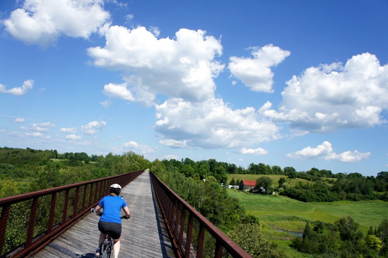
This is why I don’t understand why people pay to ride stationary bikes in windowless gym basements.
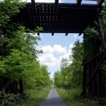
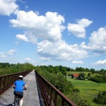
Risa and I rode the 22 km from downtown Peterborough to Omemee this weekend via an old railway that’s now part of the Trans Canada Trail. Starting from its origin in Peterborough, this rail trail runs between backyards and along a small stream before quickly leaving the city, pavement, and crowds behind on the way to Omemee and beyond. It has everything you’d expect along the way: scenic vistas, a well-maintained gravel bed, planked-in bridges and trestles like the one shown above, and an utter lack of traffic and hills. The trail continues past Omemee to Lindsay, where you can connect to other trails that will take you to Uxbridge, Fenelon Falls, or all the way up to Haliburton.
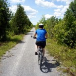
 The trail is an easy and relaxing ride for the entire length. It passes a few rural intersections and driveways at grade, while busy Highway 7 and some other driveways are carried over the trail on bridges. The urban intersections in Peterborough are similar to the ones on Toronto’s Beltline, but have curb cuts to actually let cyclists cross at the trail. The trail itself is well-maintained and can be ridden by the most casual of cyclists. Along the way you are treated to views of farms, valleys, and the rolling hills that you are not constantly climbing up and down. That’s the real joy of rail trails: you may be climbing, but the grade is so slight that it doesn’t hurt when you’re going up and it’s like having a slight tailbreeze when you’re going down.
Check out the short gallery with some of the sights along the way after the jump.
- In Peterborough, the path is reminiscent of Toronto's Beltline trail as it passes between backyards and past urban intersections.
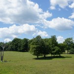
- Shortly after leaving Peterborough, the trees part for long enough to create the trail's first proper rural view.
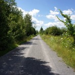
- The trail runs long and straight, with a slope so slight that it's more like riding into a gentle headwind than climbing a hill. From Peterborough, the trail rises about 85 metres over 15 km without any of the constant ups and downs that are more common on nearby roads.
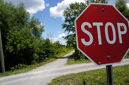
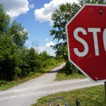
- A trail intersection features four-way stop signs. The intersecting trail seems to be someone's (rather long) driveway.
- This bridge carries a farm driveway high above the trail. Infrastructure like this betrays the trail's origin as a railway; there's no way that a crossing like this would ever be constructed to keep infrequent vehicular traffic away from bikes.
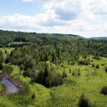
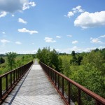
- A bucolic valley stretches below a high trestle that carries the trail.
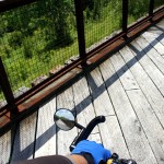
- Looking down and back, halfway across the trestle.
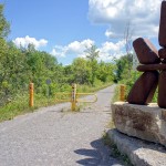
- A monument marks the trail entrance at the intersection with Emily Park Road.
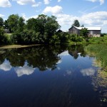
- The trail crosses the Pigeon River in Omemee. Anglers on the bridge and kayakers and canoeists in the river made this one of the busier areas on the trail.
- We broke for lunch at the beach a couple of blocks off the trail in Omemee. A sign pronounced it unsafe for swimming due to high bacteria counts and the float line that demarcates the swimming area was gathered up at the shore.
- After lunch and a water refill at the convenience store, we headed back to Peterborough.

Brilliant! I used to have a cottage in Omemee growing up and I can remember some beautiful train bridges up there; would love to ride this route, thanks for sharing!
Nice pictures, I’m looking forward to trying this.
GO Transit buses allow one to make the trip from Toronto without needing a car. I’m considering doing Uxbridge to Peterborough via Lindsay (the stop for lunch) one pleasant, cooler weekend this year, with GO on either end.
I just completed the entire Uxbridge-Peterborough trip with a stopover in Lindsay, I’ll write about that when I have some time and a working computer at home. The Uxbridge-Lindsay section reminds me of what you wrote about Peterborough to Hastings. While officially part of the Trans Canada Trail, it’s inconsitant. Within Durham Region, the trail is in varying levels of maintenance. The bridges are not suitable for bikes as they are not fully planked, at times the gravel is deep and slippery. Beyond Blackwater Jct, the trail was closed entirely for construction, without warning or a suggested detour (though a hopeful sign of better things to come). But after crossing Simcoe Street and into Kawartha Lakes, the trail was great and smooth, apart from needing some weeding.
From Lindsay, one can ride all the way to Haliburton Village on the Victoria Rail Trail, or south to Bethany on the old CP Bobcaygeon Sub.
I look forward to reading your account of the Uxbridge to Lindsay section. I’ve been doing a bit of reading about the trail through the Kawarthas and it’s clear that the trail groups are well organized and very aware of the huge benefits and relative low cost of extensive, well-maintained trails. I’m not so sure that knowledge has filtered over to Durham yet, where most developed cycling infrastructure is within 1 km of Lake Ontario.
I’ve got to put this on my list of trails to try. I don’t have a car, so it’ll be a slog getting their via GO, but it looks like it’d be worth it.
Thanks for the posting. I did the same trip today with kids, terrific.
I’m glad you enjoyed the ride. I had been hoping to make the ride again during the fall but it’ll probably have to wait until next year.
Used this trail in July 2015 when I was crossing the province of Ontario. Excellent condition for road or mountain bike when bicycle touring.
The sceneries are worth the additional km’s and slower pace than riding on shoulders od roads.