Waterfront Trail expanding to Lake Erie

The Waterfront Regeneration Trust, which manages the Waterfront Trail along the length of Lake Ontario, is expanding it to include the Lake Erie shore starting next year. This has probably been in the works for a while, but the news seems to be flying below the radar so far.

I don’t expect the trail to emerge next spring as a finished entity along the entire Lake Erie shore, but adding 620 km of signed on- and off-road trail is a huge step forward. A lot of cyclists in Ontario (myself included) salivate at the thought of our own Route Verte connecting the corners of the province. A lot of the infrastructure is already in place, with numerous long-distance trails radiating across many regions of the province. Some of them are already managed as pieces of larger trail networks like the Waterfront Trail, the Central Ontario Loop Trail, and the Trans Canada Trail. Still, completing a provincial network wouldn’t be trivial: some trails would need to be need to be improved to be suitable for casual cyclists and filling in the missing links would need to be prioritized. Closest to home, Toronto suffers from relatively poor connections to out-of-town trails. The Waterfront Trail is nice, but won’t get you to the numerous bike routes that start north of the city. That’s one reason I like the hydro corridors so much: they’re quiet routes through the most car-centric parts of the city and have tremendous potential for linking to trails beyond Toronto’s boundaries. We need more of them.

With the Lake Erie extension, I hope that the Waterfront Trust has learned some lessons from 15+ years of wrangling the trail along Lake Ontario. Here are two improvements I’d like to see applied to the trail on both lakes:

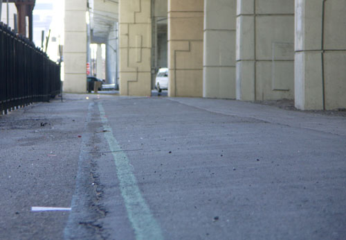
  • Follow an obvious and sane route. I’ve ridden the Waterfront Trail through Oakville a number of times and have never been able to follow the official route. It seems to constantly duck onto short side streets for one or two blocks before coming right back up to Lakeshore Road. The route may travel one block through a park that is otherwise two blocks away from the through-route. The little jogs just add distance and confusion to the overall route and make it incredibly easy to get lost. The situation is the same in parts of St. Catharines, Toronto, and probably elsewhere. I’d much rather just have a relatively straight route than one that takes me two blocks out of my way so that I can ride for one block on a quiet street that’s still nowhere near the water. A cyclist shouldn’t need to consult a map to follow a signed route, any more than a driver should need a map to drive straight on the 401.
  • Have more visible and more consistent signage. One of the reasons it’s so easy to lose the trail as it zigzags from street to street is that many directional signs are so small that they border on invisible. The small size is compounded by the fact that many directional arrows are pale orange on a tan background and don’t exactly call your attention to them. You’ll never see one unless you’re actively looking for it. I understand that there was some NIMBY resistance in the early days of the Waterfront Trail, but surely it’s well-established now and can push communities for better signage. Signs have improved in a lot of areas, but there’s still much work to do.

Ghosts of the Martin Goodman Trail

The forgotten Martin Goodman Trail in the shadow of the Gardiner Expressway

I rediscovered the mostly-forgotten northern portion of the Martin Goodman Trail quite by accident last summer. I was stuck in a surprise downpour while riding along Queens Quay and scooted up to Lake Shore to hide under the Gardiner for a few minutes. And there they were, the familiar blue and green lines marking the original alignment of the Martin Goodman Trail.

I rode along and was quite surprised at how much of the original trail remained despite more than 15 years of encroachment by condo projects and neglect by the city. I was able to ride from York Street to Stadium Road without interruption, even though one section of the trail has been co-opted for a condo building’s back lawn.

The forgotten Martin Goodman Trail runs into a condo's back lawn near Spadina

I started cycling this portion of the trail regularly again this spring and met with another surprise: riding along here can be a lot faster and easier on the nerves than riding along Queens Quay. Not only is there less traffic to contend with, but the traffic lights usually favour traffic along Lake Shore rather than the intersecting streets. As a result, you can frequently zip from York Street to Stadium Road with only one or two brief stops for cross traffic. No more stopping for red lights at every driveway and parking lot along the way.

Old-timers like me will remember that the downtown section of the trail was always a bit of a puzzle. The original westbound alignment had you crossing from the south side of Queen’s Quay near Sherbourne to the north side, continuing along the north side to York Street, sometimes on the road, sometimes on a marked section of the sidewalk. You turned north on York and continued riding beside Lake Shore Boulevard all the way past the pre-loft Tip Top Tailors building and HMCS York driveway before swooping into Coronation Park.

Going east, cyclists were expected to ride on the north side of Queens Quay until Sherbourne, and then cross back to the south side before picking up the off-road portion of the trail again.

The various north-south transitions were so poorly designed with zero traffic control that most cyclists eventually ignored them completely and rode straight along Queens Quay for the entire distance.

The city eventually acknowledged reality and redesigned both ends of this stretch. The eastern portion of Queens Quay got proper directional bike lanes along each side of the street between Parliament and Yonge, and the western end got bike lanes from Spadina to Stadium Road and a direct connection behind the Tip Top building to the off-road trail.

With the extremities fixed, the middle seemed to fade bit by bit. The trail on the north side of Queens Quay east of York was repaved at some point and the distinctive blue and green trail markings were left off. Signs pointing to the continuation of the trail a block north disappeared. The trail beside Lake Shore was degraded one section at a time by adjacent construction. Eventually, memories faded with the paint and the trail just seemed to stop at Yonge and resume again at Spadina, with nothing but a stressful ride along Queens Quay in between.

The original alignment was never beautiful and was only barely functional. Sadly, it was and remains better than the current alternative. The upcoming Queens Quay redesign (previewed as Quay to the City last summer) should go a long way toward finally fixing this section of our waterfront trail.