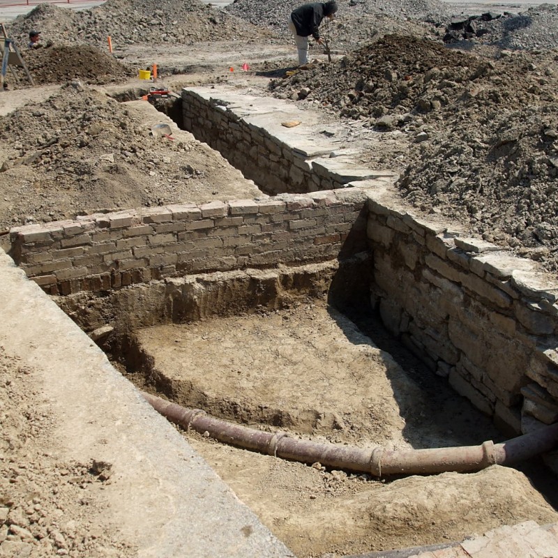
East Barracks uncovered

Archeological dig, East Barracks of New Fort York (Stanley Barracks)

An archaeological dig across from the National Trade Centre at Exhibition Place is uncovering the foundations of the East Barracks, part of the New Fort that replaced Old Fort York in the 1840s. The only one of the original buildings that survives intact is the officers’ quarters, commonly referred to as Stanley Barracks (which was actually the name of the whole facility). The site supervisor told me that they dug exploratory trenches about four years ago and discovered that the old foundation was still mostly intact, stretching a couple of hundred feet under the parking lot. The dig is in front of the site of the new hotel that has exclusive rights inside Exhibition Place. The developer is planning to cover the majority of the remaining foundation with glass and use it as a feature in the entrance.

A short image gallery is after the jump.

Read More …

The Newmarket Canal

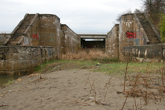
Standing in front of the middle lock

There’s an interesting piece of history hiding in the outer reaches of the GDA (Greater Dodgeville Area, loosely defined as any place I can reach by bike) just north of Newmarket: the scattered remnants of the Newmarket Canal.

This never-finished canal was to be a southerly branch of the Trent-Severn canal from Lake Simcoe to Aurora via the Holland River. This was not a trivial undertaking for many reasons, not the least of which was that there just wasn’t enough water in the river to operate a canal. The initial plan for the canal called for reservoirs to be fed by water diverted from Lake Wilcox, the source of the Humber River. That plan was later shelved as being too expensive and politically unpopular, and was replaced by a scheme to pump the necessary water uphill from Lake Simcoe to the top of the Oak Ridges Moraine at Aurora.

Work on the canal was to be done in three stages: the first required that the river be dredged from Lake Simcoe to Holland Landing. The second required three locks to be built between Holland Landing and Newmarket (the second of those locks is pictured above). The final phase, from Newmarket to Aurora, would require an additional five or six locks depending on the final route, which still hadn’t been finalized when construction began.

Even as the work on the canal began in 1906 and continued for five years, there was still no clear plan for keeping enough water in the canal to keep it navigable during any period of the year outside the spring thaw. Increasing public opposition, escalating costs, and a change in government ultimately doomed the project in 1912 after years of political shenanigans, interference, and scandals that would make most modern politicians blanche. At that point, most of the work on the canal through Holland Landing and up to Newmarket had been completed. The three lock structures and the base of one swing bridge that had been built before the project was called off still stand along the east branch of the Holland River north of Newmarket.

James T. Angus’s comprehensive book, A Respectable Ditch: A History of the Trent-Severn Waterway 1833–1920, details the tortuous political and physical paths of the entire project’s 90 years of debate, design, and construction. It devotes a chapter to the Newmarket Canal debacle and is well worth reading.

This was at least the second planned canal along this route. The other would have gone straight through the Oak Ridges Moraine and connected to Lake Ontario via the Humber River.

I first visited two of the abandoned lock structures almost 20 years ago, shortly after learning about the Newmarket Canal in Ron Brown‘s excellent guidebook, 50 Unusual Things to See in Ontario. I finally visited the third lock and the swing bridge just this past September.

Looking back now, 50 Unusual Things was probably what set me off on my habit of exploring the GDA and finding unusual sights and abandoned bits of the city. Damn you, Ron Brown!

My most recent cycling visit to the canal was on Saturday, during which I was trapped under a sheltering bridge for an hour and a half by that big storm that whipped across southern Ontario. I eventually called Risa to rescue me with the car after giving up hope that the lightning, rain, and wind would let up in time for me to get back home at a reasonable hour.

The irony here is that I was stuck within spitting distance of the East Gwillimbury GO station. I could easily have gone home by train, but the next one was 36 hours away on Monday morning and I wouldn’t have been able to take my bike on it. Hello GO? Weekend service, please.

More pictures below the fold.

Read More …
Ghosts of the Martin Goodman Trail

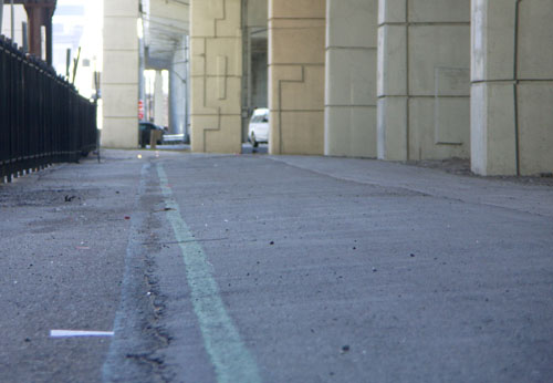
The forgotten Martin Goodman Trail in the shadow of the Gardiner Expressway

I rediscovered the mostly-forgotten northern portion of the Martin Goodman Trail quite by accident last summer. I was stuck in a surprise downpour while riding along Queens Quay and scooted up to Lake Shore to hide under the Gardiner for a few minutes. And there they were, the familiar blue and green lines marking the original alignment of the Martin Goodman Trail.

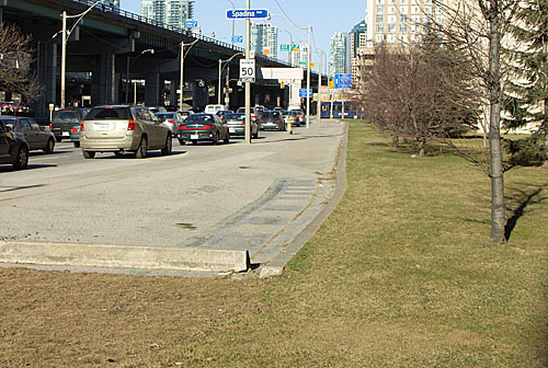
I rode along and was quite surprised at how much of the original trail remained despite more than 15 years of encroachment by condo projects and neglect by the city. I was able to ride from York Street to Stadium Road without interruption, even though one section of the trail has been co-opted for a condo building’s back lawn.

The forgotten Martin Goodman Trail runs into a condo's back lawn near Spadina

I started cycling this portion of the trail regularly again this spring and met with another surprise: riding along here can be a lot faster and easier on the nerves than riding along Queens Quay. Not only is there less traffic to contend with, but the traffic lights usually favour traffic along Lake Shore rather than the intersecting streets. As a result, you can frequently zip from York Street to Stadium Road with only one or two brief stops for cross traffic. No more stopping for red lights at every driveway and parking lot along the way.

Old-timers like me will remember that the downtown section of the trail was always a bit of a puzzle. The original westbound alignment had you crossing from the south side of Queen’s Quay near Sherbourne to the north side, continuing along the north side to York Street, sometimes on the road, sometimes on a marked section of the sidewalk. You turned north on York and continued riding beside Lake Shore Boulevard all the way past the pre-loft Tip Top Tailors building and HMCS York driveway before swooping into Coronation Park.

Going east, cyclists were expected to ride on the north side of Queens Quay until Sherbourne, and then cross back to the south side before picking up the off-road portion of the trail again.

The various north-south transitions were so poorly designed with zero traffic control that most cyclists eventually ignored them completely and rode straight along Queens Quay for the entire distance.

The city eventually acknowledged reality and redesigned both ends of this stretch. The eastern portion of Queens Quay got proper directional bike lanes along each side of the street between Parliament and Yonge, and the western end got bike lanes from Spadina to Stadium Road and a direct connection behind the Tip Top building to the off-road trail.

With the extremities fixed, the middle seemed to fade bit by bit. The trail on the north side of Queens Quay east of York was repaved at some point and the distinctive blue and green trail markings were left off. Signs pointing to the continuation of the trail a block north disappeared. The trail beside Lake Shore was degraded one section at a time by adjacent construction. Eventually, memories faded with the paint and the trail just seemed to stop at Yonge and resume again at Spadina, with nothing but a stressful ride along Queens Quay in between.

The original alignment was never beautiful and was only barely functional. Sadly, it was and remains better than the current alternative. The upcoming Queens Quay redesign (previewed as Quay to the City last summer) should go a long way toward finally fixing this section of our waterfront trail.

Inspiration

No, I’m not talking about the kind of inspiration you get from Successories.

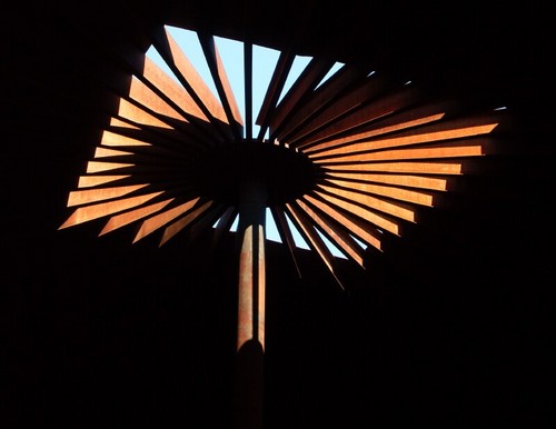
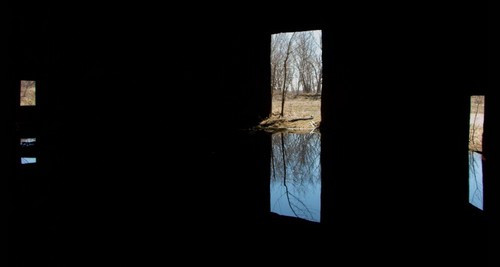
A post on the Spacing Wire last week pointed to a short film called Drum 13 (requires QuickTime 7) by Tony Round. The description read, “a banjo and a massive abandoned Cherry Beach oil drum really do belong together.” Drum 13 was filmed in February 2005. It turns out that in April 2006, I had visited the same location and taken these pictures, among many others, of that oil tank:

Industrial Blossom

Portals

While I was there, I was struck by how this big old boring piece of industrial detritus could be so compelling a subject and offer so many interesting studies in light and form. I’ve always enjoyed taking pictures of industrial ruins, but this place was special. I couldn’t believe that I’d ridden my bike past it for so many years without once venturing onto the site and vowed to come back as the seasons changed throughout the year.

But by June 2006, the site had been leveled, and you never would have known that the empty field had ever held anything more substantial. It is currently being developed into the transitional sports fields in the port lands. The experience underscored the importance of timing: if you have a chance to take a picture, take it — the scene may not exist an hour from now, never mind next week or next month.

I lamented the loss of the picturesque location, but didn’t know that anyone else had appreciated its interesting features before I saw Drum 13 posted online last week. I wondered if anyone else had been artistically inspired by this storage tank. Some quick Googling found that at least a few other photographers and some musical experimenters have documented the location over the years. It’s good to know that I wasn’t the only fan of this abandoned piece of the city.