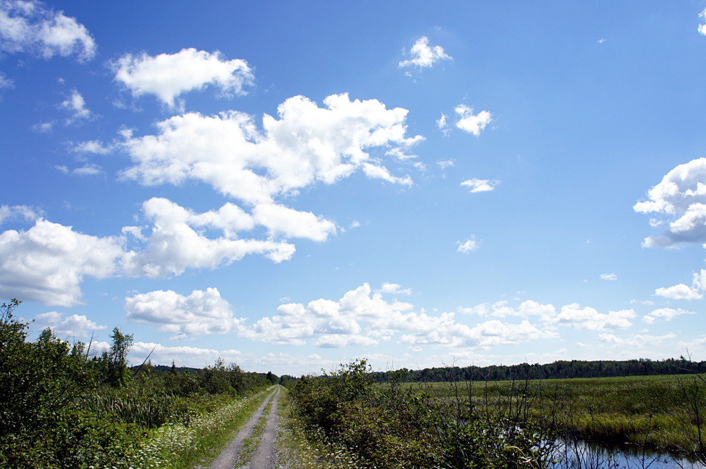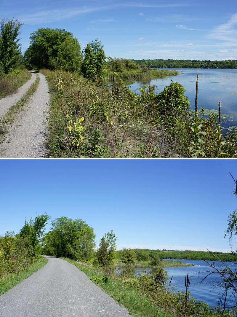
The Millennium Trail in Prince Edward County.
Nothing gets you going in the morning like a hearty French toast breakfast, and Magnolia Meadows host Isabelle didn’t disappoint. An hour after polishing off a stack of French toast, a pot of tea, and a glass of juice, I was ready to hit the road again on Day 2 of my mid-July ride from Kingston to East Dodgeville. It was just a bit cooler than it had been the previous day, but still uncomfortably hot as I got underway shortly after 10 a.m. But the killer this day wasn’t the heat or the humidity; it was the wind. Blowing briskly from the west at a steady 40 km/h (and gusting to 60 km/h), Old Man Wind’r would be my nemesis for the next few hours as my route took me straight into his gaping maw.
The Friday ride was to start with a short stretch along the main rail trail in Prince Edward County, the Millennium Trail, before moving onto local roads for the majority of the ride into Cobourg. I joined the trail a short distance north of the B&B. I’ve shared trails with dirt bikes, ATVs, and even full-sized touring motorcycles, but this was the first time I’ve ever had to share a rail trail with golf carts: in Wellington, the trail goes through a golf course and carts zip onto the trail for short distances to get to the next hole. Fortunately, it only takes a couple of minutes to get past the course and I only saw a couple of carts.

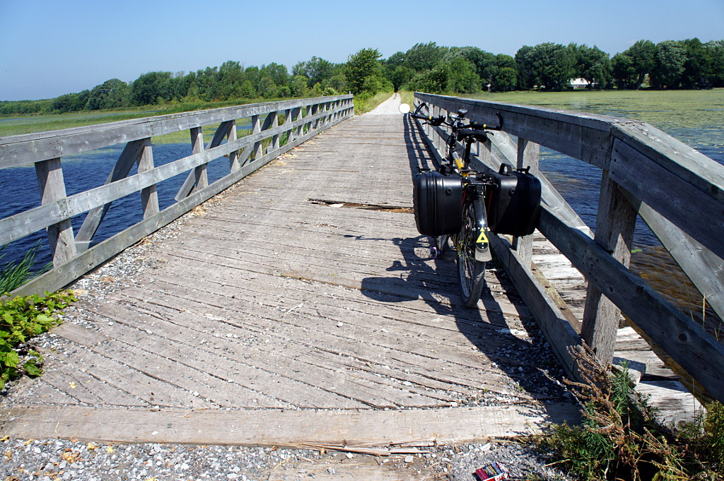
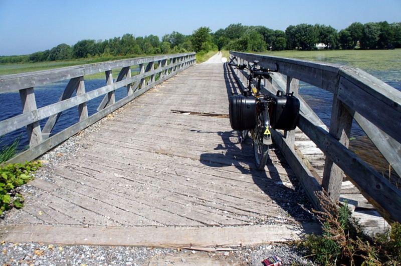
A causeway carries the Millennium Trail across Consecon Lake. I hope there’s a bridge at the far end.
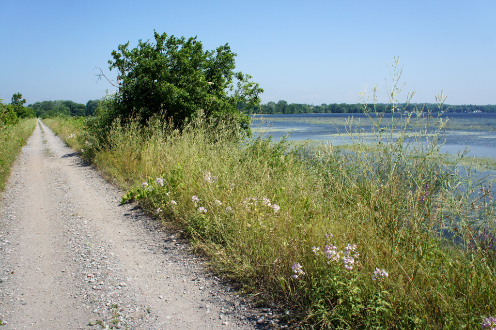
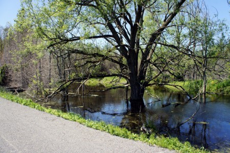
This day’s route called for me to stay on the rail trail for 3-4 km and then venture back onto the roads for the rest of the day. But with the open road came my first taste of the headwind that would bedevil me for the rest of the day. After a few minutes, I scurried back to the trail and the sheltering vegetation lining both sides and keeping the wind to a minimum. Although the trail surface varied from smooth limestone dust to sandy double track and large gravel, it was far easier to maintain a good pace on the rail trail than to battle the wind.
Being beaten back to the trail turned out to be a blessing in disguise because the Millennium Trail was easily the best part of the ride on either day. The wind was controlled, the scenery beautiful, and the trail was wholly deserted: I didn’t encounter a single person on the trail after I passed the golf course on my way out of Wellington.
The only problem: at one point, my GPS and my printed Google maps disagreed over whether the trail continued across a bridge over Consecon Lake up ahead. Should I keep going on the trail or return to the road grid to get around this potential dead end? I decided that I’d rather have to double back on the trail than ride on the road if I didn’t absolutely need to, so up the trail I went. In the end, Google was right: the trail followed a causeway out across Consecon Lake and an old bridge did indeed span the gap that my GPS showed. And the bridge was a little more confidence inspiring than it was in 2004.
Most of the Millennium Trail isn’t in good enough condition for casual cyclists on hybrid or city bikes, but it’s a easily ridable on anything with wider tires. It was a pleasure to ride on a front-suspension mountain bike, but rigid forks and well-padded gloves would have done just as well. The entire trail northwest from Wellington is a great ride. Next time, I’ll ride it all the way from the eastern end of the County in Picton. But all good rail trails must come to an end and I rejoined the road to cross the western end of the Murray Canal outside Brighton. Away from the busy Loyalist Parkway, the crossing at this end of the canal is much quieter and allows you to skirt Brighton rather than going through the town on major streets. Highly recommended for all cyclists riding between Wellingon and Presqu’ile. Unfortunately on this day, with the open road came the fierce wind and the afternoon heat, kilometre by kilometre sapping my will to ride.
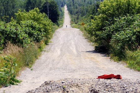
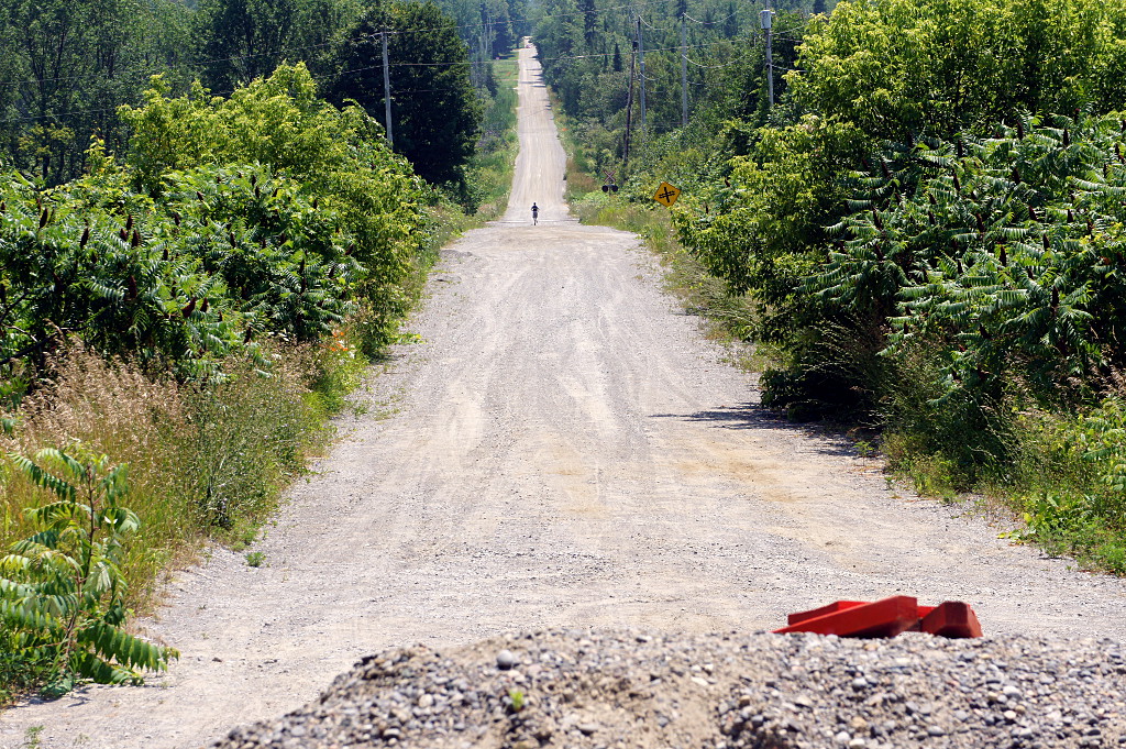
From the closed bridge on Barnes Road, a lone jogger plods down the deserted and very hot road.
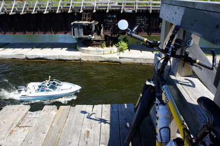
I rode through the south end of Brighton, past Presqu’ile Provincial Park and toward Cobourg, my target for the day. I wanted to stick as close to the lake for as long as possible before joining the main road to Cobourg, so I took a chance when I saw a “bridge closed” sign directing me up to the highway as a detour. It meant I’d be rolling the dice for a second time in one day on a potentially non-existent bridge, but what the hell; at least I’d have a tailwind for a few minutes if I had to backtrack. Two and a half kilometres after the sign, a gravel barrier blocked vehicular access to the railway overpass on Barnes Road, but it was obviously still well-used by pedestrians. I hefted my bike over the pile of gravel and sat down for lunch on the bridge, just a few hundred metres short of the road to Cobourg.
At this point, it was clear that finishing the ride all the way to Cobourg would be a serious challenge. Although this day’s ride was planned to be around 25 km shorter than the previous day’s, the wind was taking so much out of me that it might as well have been 50 km longer. As I turned onto the main road west to Cobourg and back into the full-on headwind, I knew I was defeated. I slogged through Salem, Colborne, and Wicklow before finally succumbing to the heat and wind at Grafton, calling Risa to pick me up about 15 km short of our planned meeting place in downtown Cobourg. By that time, my pace had been slowing down so steadily that my GPS had been declaring Cobourg to be just an hour away for the previous 45 minutes.
I’d definitely do the entire ride again if I had the chance, but I’d order up cooler weather and a much lighter breeze next time. And barring that, I’d head east with the wind, rather than west into it. That said, I highly recommend the entire route I took. I’d make more detours with more time and more bike-friendly weather, but the route was an excellent combination of being away from traffic on backroads and quiet trails, together with scenic highways when necessary. If I’d been on a road bike, I would have had to stick a little closer to civilization for most of the second day. It’s one reason that I like doing tours on my mountain bike: it can be a bit more challenging if I’m just riding along paved roads, but it gives me a lot more freedom when it comes to selecting a route and making detours along the way.
I bracketed this ride with a bus trip to Kingston and a car pickup in Cobourg, but the trip could just as easily have started with a train ride to Kingston and ended at the Cobourg VIA station for a ride back to Toronto. Or add an overnight stay in Cobourg and a third day of riding to the GO bus in Newcastle or GO train in Oshawa.
The gallery from the ride is below the fold.
Read More …