Upper Canada Heritage Trail

Upper Canada Heritage Trail in Niagara-on-the-Lake

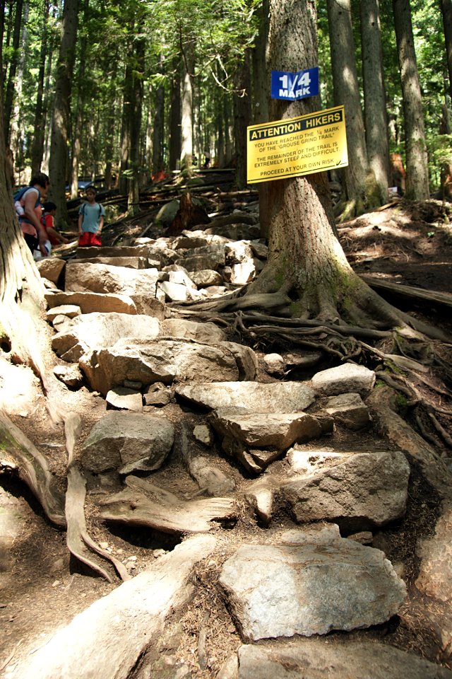
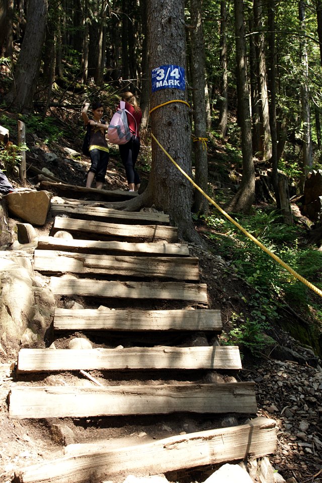
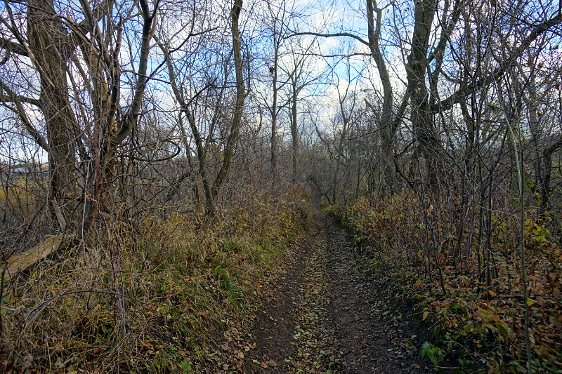
The first leg of the Upper Canada Heritage Trail looks like many other rail trails.

Upper Canada Heritage Trail in Niagara-on-the-Lake

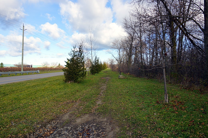
The majority of the trail runs beside Concession 1 and passes numerous orchards and vineyards.

Risa attended a meeting in Niagara-on-the-Lake last weekend and I tagged along for the drive down the QEW so that I could take a walk down an old railway, now the Upper Canada Heritage Trail. It travels about 11 km from the Bruce Trail west of Queenston down to the Waterfront Trail on Lake Ontario. Combined with the first few kilometres of the Bruce Trail from Queenston Heights and the General Brock Trail along the Niagara River, it constitutes a day-long hiking loop over mostly easy terrain. The UCHT would definitely be the quieter side of the loop, especially at this time of year.

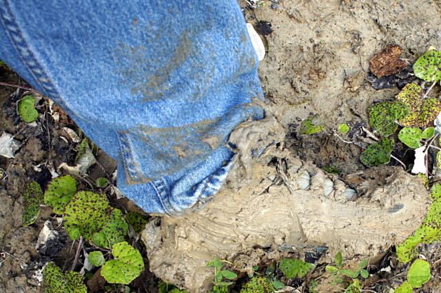
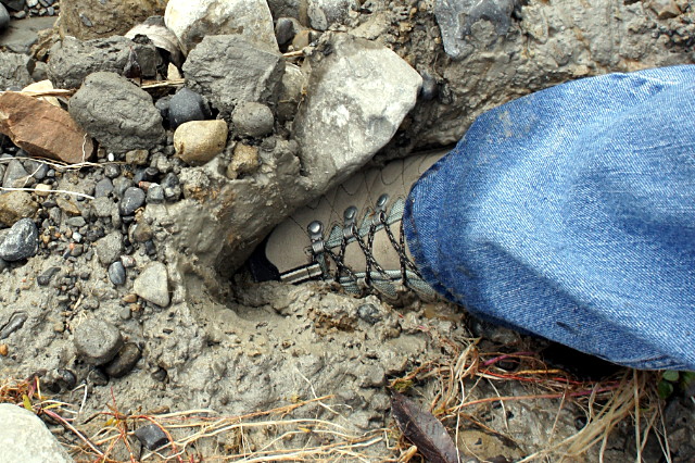
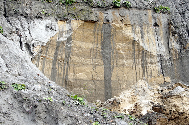
Risa tossed me out of the car at the trailhead at York Road and Consession 2 and told me I had three and a half hours to get to Fort George or I’d be walking all the way home. The terrain was about what you’d expect in a rail trail: mostly flat, mostly straight, and mostly running behind farms. A portion of the trail just north of York Road was completely washed out: about 20 metres of the raised railbed had collapsed into a jumbled mess of trees, dirt, and rocks below. The resulting hole is navigable on foot with sturdy boots and a bit of care, but don’t expect to pass with your bike or horse. Several large potholes and a subsiding trail leading up to the washout hint that much more of the old railbed here is probably going to collapse in the near future.

The long middle stretch of the trail runs dead straight and flat beside Concession 1 and is a pleasant walk alongside a quiet country road lined by numerous vineyards and orchards. Autumn is usually my favourite time to go hiking but this portion of the trail would probably be much nicer in the late summer with the sights and smells of all the fruit coming into season.

Upper Canada Heritage Trail in Niagara-on-the-Lake

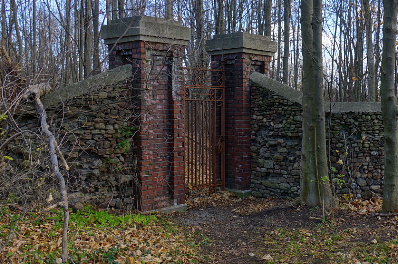
The third section of the trail curves up through suburban Niagara-on-the-Lake heading toward downtown. It feels like more of an urban rail trail, with numerous well-kept backyards opening right up onto the trail. Just imagine having a section of the Bruce Trail literally outside your back door. This section is also home to the most interesting sight on the trail, a long stone wall. It looks long abandoned and neglected at first, but it does still separate private homes from the trail. Numerous sections have fallen down and been replaced by ugly wooden or chain-link fences,  while another portion would have fallen over if it weren’t propped up by three large metal beams.

The trail ends at the Waterfront Trail, a short walk away from downtown Niagara-on-the-Lake and Fort George. All in all, it’s a nice walk, if not a challenging hike.

Dodge's third rule of hiking

Dodge’s first rule of hiking is that you will finish a roll of film just before a deer bounds across your path. The first rule was deprecated about ten years ago. The second rule of hiking is that if you bring a lot of X you won’t need any of it, but if you bring just a little or no X at all, you won’t have enough (where X is anything that you put into or take out of your daypack). The second rule is still in force. The third rule states that on the first hike you take with a brand new pair of boots, you will end up sinking in mud halfway up your shins. The left boot, above, went in first. The right boot, below, was sacrificed so that I could pull the left boot back out.

So much for a light hike to break them in.

In all seriousness, safety is the first rule of hiking and muck like this at the base of a sheer cliff is enough to turn me around. I was walking across the base of a hill that was obviously supersaturated and unstable. Well, it became obvious once my first step sank straight into what looked like hard-packed dirt. I could tell there had been a recent slide on the hill above but once I pulled my boots out and surveyed the scene again, it wasn’t clear whether the slide was six months or six minutes earlier. As I stood there, I could see a few small stones and clumps of mud falling one by one from the top of the hill and decided that this just wasn’t a good place to be contemplating a way forward.

Also on sober second thought, the interesting water patterns in the soil on the hill probably indicate a certain level of instability:

Unstable hillside

I’m sure that if I’d gotten close enough to touch that part of the cliff, it would have been just as soft as the muck I stepped in.

The tough part about turning back here was that my destination was only about 300 metres on the other side. I’d already caught a glimpse of it. If I could have navigated the 30 metres or so of this muck, I would have been there in less than five minutes. There was only one other possible path that would have allowed me to get there from my chosen starting point this day, and it was across the top edge of this very same hill. Sadly, I’d already tried traversing the top before thinking that going across the bottom might work better. Next time I’ll heed Dodge’s second rule of hiking and bring the hip waders for a river crossing to guarantee that I’ll find a nice easy overland route to my target.

Grouse Grind

Risa and I are on vacation out west. I used the occasion to climb Grouse Mountain, one of the peaks overlooking Vancouver. The interesting thing about Grouse Mountain is that you can take public transit to it: a quick ferry and bus ride  from downtown Vancouver gets you right to the base of the mountain for $3.75. Ah, for TTC and GO service like this to some of Toronto’s far-flung attractions. Grouse Mountain isn’t huge by mountain standards, but it’s still a lot bigger than anything I’ve climbed in Toronto. I’ll have more random thoughts about Vancouver in a later post or two, but for now, here’s a gallery of my climb up the Grouse Grind.