Goin' down the road

Goin’ down the road

It feels like months since I’ve gotten out for a good ride but I was finally able to hit the (dirt) road yesterday, heading out into the farthest reaches of Scarborough. With the country roads, fields of corn, tangled meadows, and overgrown forests, you’d never know that you were still inside Toronto on the municipal street grid. But then you pass one of the familiar bike route signs (seen here at the rural intersection of Beare Road and the wonderfully-named Plug Hat Road) and you know that you’re still within reach of civilization:

Bikeway network signs at Beare and Plug Hat

This isolated corner of the city is plagued by illegal dumpers and it shows in the informal signage along the roads:

Informal signage on Reesor Road

In the last couple of years, northeastern Scarborough and neighbouring northern Pickering has become one of my favourite cycling destinations. The best thing about riding there (or almost anywhere) at this time of year and in cool, rainy weather is that you basically have trails and roads to yourself.

I'm from the government, and I'm here to…

 Greenwashing

expropriate your farm, board up your house, and let much of your land lie fallow while we spend 40 years trying to justify building a huge and unnecessary airport on prime agricultural and ecologically sensitive land. Um, I mean, I’m from the government and I’m here to preserve your green space.

(Doublespeak at its finest, as seen on the site of the still-on-the-books Pickering airport.)

Pedestrian infrastructure, suburban style

 Boldly going where no pedestrian has gone before

I’ve long thought that there must be some provincial regulation requiring municipalities to install pedestrian signals whenever they reconstruct a signalized intersection. I’m all for the idea, but implementations sometimes trend toward the bizarre.

Take, for example, the intersection of Highway 7 and Westney Road in rural Pickering. It’s near the hamlet of Greenwood, with Valley View Public School just down the street and the Pickering Museum a country block away, but I highly doubt that more than a couple of pedestrians grace the intersection on the busiest of days. There are no sidewalks anywhere around here. Yet pedestrian signals and their activation buttons stand guard over each corner of the intersection, just waiting to be pressed by the hapless soul who finds himself lost here. So far so good. But when you look closer, you realize that with no sidewalks and corrugated beam barriers sheltering the buttons at three corners, the only way to activate them is to stand on the road. On the fourth corner, pedestrians have to climb a small weedy hill to press the button:

An inconvenient button

But even better than the activation buttons are the curb cuts, dutifully guiding people in wheelchairs and with baby strollers into the guardrails and onto non-existent sidewalks:

Curb cut to nowhere

Curb cut to nowhere

The whole thing smacks of some bureaucrat following the letter, but not the spirit, of the law.

House on the hill

Lonely house on a hill

I came across this curious sight out near Guelph this past weekend. The old house, no doubt saved from demolition by a heritage designation, sits in the middle of a large lot that has been scraped clean of soil and flattened for what is sure to be a completely unremarkable subdivision. The patch of soil the house sits on is now maybe 8 feet above the surrounding terrain. The interesting thing is that there’s absolutely no sign of action here: there’s no equipment on site, no sales pavilion, no signs, no building material, nothing. It’s almost like someone just wanted to cart away all the topsoil and leave behind a moonscape.

The view reminded me of this spectacle last year in China.

Abandoned DVP on-ramp

Old DVP on-ramp from York Mills Road

Driving down the DVP a couple of weeks ago, I noticed an old roadway cutting through the brush just north of York Mills Road. I had a pretty good idea of what it was, but a quick look at Google Maps confirmed my suspicion: it was an abandoned on-ramp to the southbound Don Valley Parkway from westbound York Mills Road. The current DVP ramps at York Mills were reconfigured during construction to the overpass beginning in 2005. The northwestern loop of the cloverleaf was removed entirely. Or was it?

Old DVP on-ramp from York Mills Road

I went back by bike last weekend (the same ride where I blew out a tire) to investigate and was quite surprised by what I found. Not only was virtually the entire ramp still intact, but there had been no attempt to restrict access to it. I was expecting to see the traditional Toronto chain-link fence surrounding the road, but all I had to do was ride up a little hill before I was greeted by the remnants of the ramp in all its glory. I’m not saying that there should be a fence, just that I was expecting one. Toronto officialdom is so paranoid about putting fences and warning signs around everything more challenging than a sidewalk that I never imagined for a second that it wouldn’t be all locked up.

Old DVP on-ramp from York Mills Road
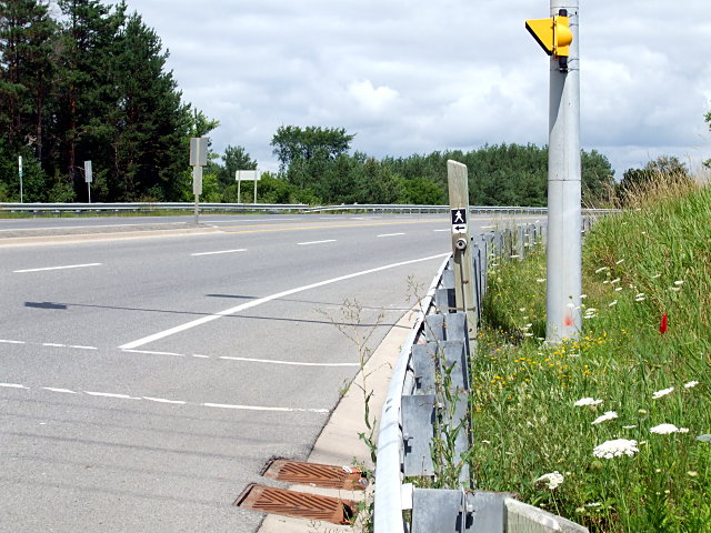
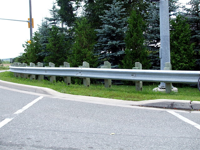
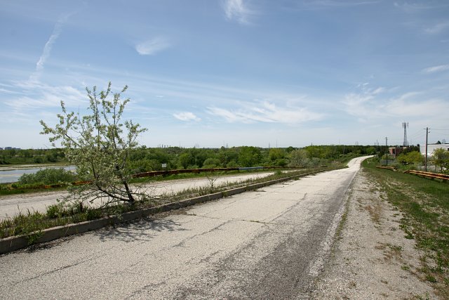
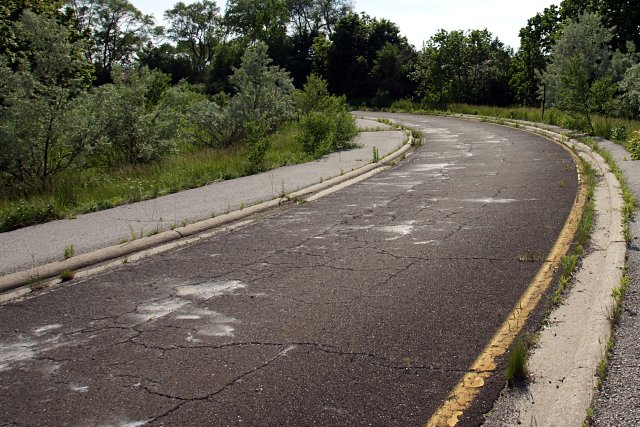
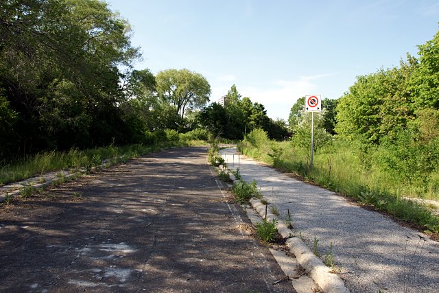
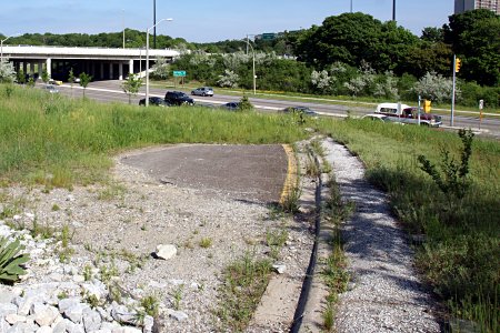
Although the subsequent landscaping at York Mills Road put the ramp’s remnants out of sight, the bulk of the road still sits behind the embankment, where it’s being slowly consumed by encroaching weeds. The posts that held up corrugated beam safety barriers around the perimeter of the ramp were cut down to the ground and a stone-lined drainage ditch has been dug across the roadway, but the ramp is otherwise intact to within a few metres of the highway.

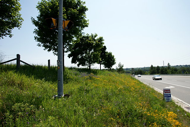
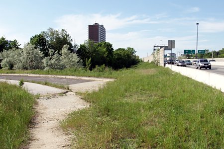
Although you’re never farther than 100 metres from either York Mills or the DVP, the curving tree-lined ramp quickly isolates you from both. Even with the sound of traffic in the background, it’s surprisingly relaxing.

Old DVP on-ramp from York Mills RoadThe current Google Maps image of the area, probably taken in 2005 or 2006, clearly shows an excavator perched at the very bottom of the ramp, presumably preparing to rip up the 50 metres or so of the roadway that was removed.

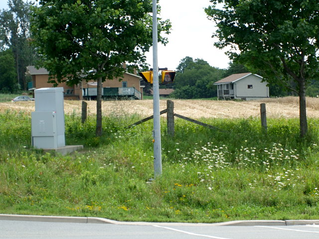
At some point, the now-unused land here will probably be sold off for—what else?—condos, and another little piece of Toronto infrastructure will disappear completely. In the meantime, this hidden corner of the city is being rezoned by the local flora.

A version of this post originally appeared on Torontoist.

Old Indian Line: Part 1

Indian Line looking north from near the CN tracks

Way up in the very northwestern corner of the city, the old Indian Line used to mark the boundary between Etobicoke and Peel Region (Mississauga and Brampton). The road carved its way through farm fields and across a bridge over the Humber River before continuing north past Steeles Avenue. Most of the old road was effectively wiped out by the initial construction and subsequent widening and extending of Highway 427 starting in the late 1960s and continuing through the early 1990s. Other portions of the road fell victim to realignments of Albion Road, Steeles Avenue, and Regional Road 50 heading north out of the city. But as with other abandoned roads in the city, a few stretches of the old roadway still exist. A tour and more pictures follow.

Read More …