Spring on the Spit

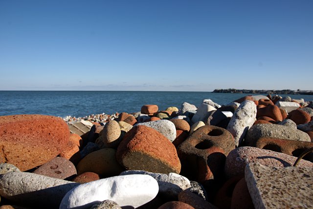
Brick Beach on the Leslie Street Spit

I usually start stretching my cycling legs around mid-March each year, getting ready for longer rides in the season ahead. Although I commuted and ran errands on my bike throughout this winter, I hadn’t been out for any pleasure rides of significant distance since November. But when that sun starts melting the snow and the days start getting longer, the call of the road becomes too strong to resist. I don’t care if it’s still cold and windy outside; my legs want to spin.

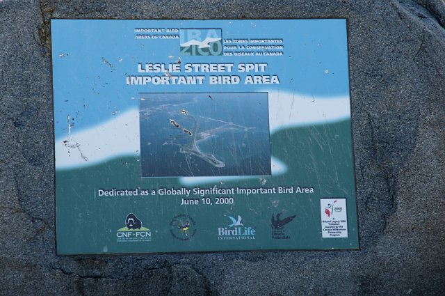
The Leslie Street Spit is my most frequent late winter/early spring destination. It’s one of the few car-free places in the city where you can ride at this time of year and not worry about dealing with snow and ice. It’s also among the most photogenic destinations with a wider variety of landscapes than you’d expect of a long finger of dirt in the lake.

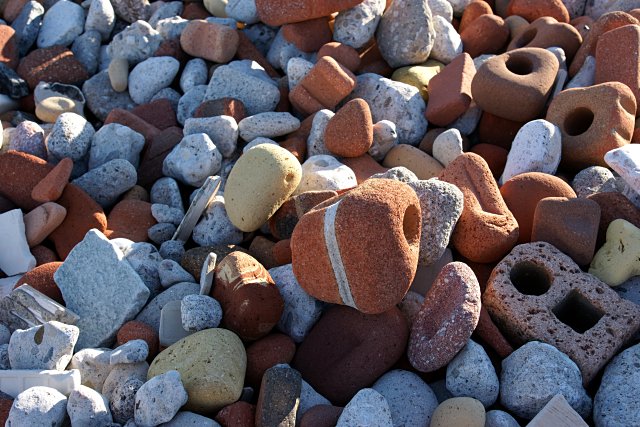
This beach, for example, is made almost entirely of bricks. The constant action of the water has worn away most of the corners so they look like colourful bars of soap. A few feet in from the shore, most bricks still have rough edges. They get smaller and smoother as they get closer to the water. At the water’s edge, they look like colourful little pebbles. In a few years, this could look like just another sandy beach.

Old bricks on the beach, Leslie Street Spit

In the middle of this picture, you can see mortar still holding the remnants of two eroded bricks together.

I’ll have more pictures from the Spit in the days ahead.

Snow mountain revisited

Snow mountain revisited

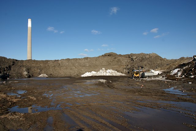
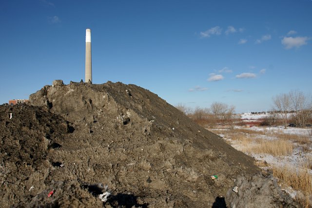
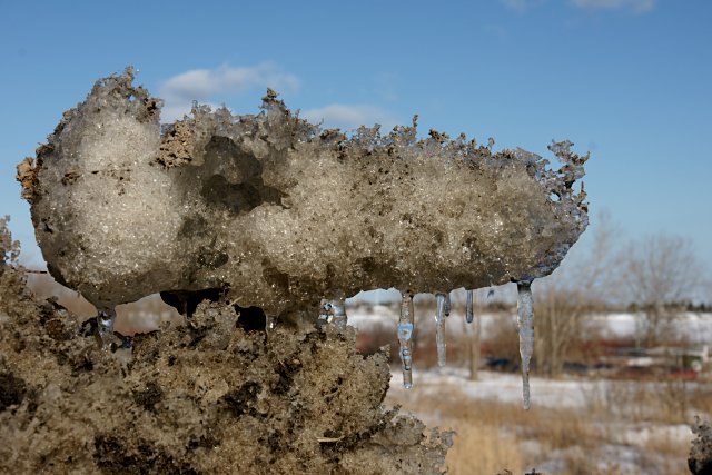
All of the heavy equipment was parked at the other end of the lot when I revisited the Unwin Avenue snow dump this weekend, so there’s not much in these photos to establish scale. The top of that pile of white snow at the centre of the picture above is about 8 feet high, if that helps. Enough of the snow has already melted that what’s left is indistinguishable from a pile of dirt from a distance. As the spring progresses, it’ll become indistinguishable from a pile of dirt even close up. All of this will be melting untreated virtually straight into the lake. The Don is also in for a rough spring and summer with melt from the snow dumps in the valley almost guaranteed to foul the river through July.

Unwin snow mountain with Hearn Station & smokestack poking out from behind

Tumour on Snow Mountain

What a way to end a vacation

Welcome home

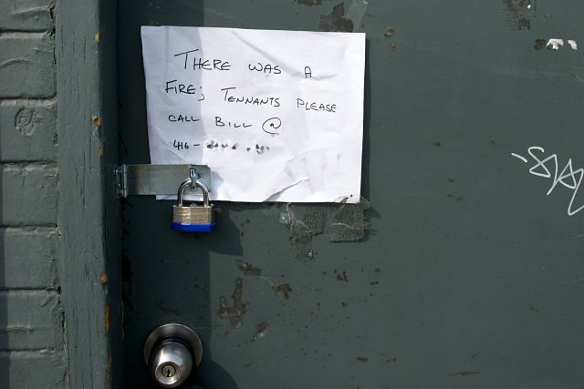
Imagine coming home from your March Break vacation to find this sign taped to the padlocked entrance to your apartment. Welcome back!

Update:  This isn’t my place; the sign was attached to a Danforth Ave. apartment the other day. I doubt I would have had the presence of mind to take a picture if I’d returned home to such a sight.

River watching: couch potato edition

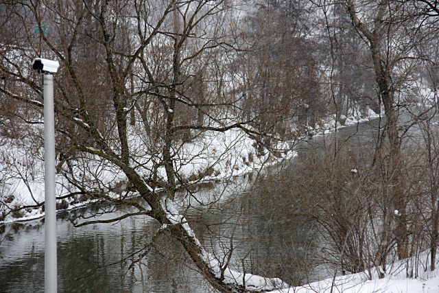
Camera watching for traffic jams on the Don River

The appearance of yet another traffic camera in the city is hardly remarkable. But it is a little unusual when that camera is watching traffic on the Don River just south of Pottery Road. Although it was used extensively for transportation in its almost-forgotten past, the Don is not exactly known for its 21st-century traffic jams and accidents.

The camera, installed about a year ago beside a gauge house that monitors river levels and flow, is actually used by Toronto and Region Conservation (TRCA) to provide visual correlation of data from other instruments. While a gauge may indicate only that river flow is lower than normal, the camera can see an ice dam. This camera is currently the only one in TRCA’s stable, but they’re trying to identify suitable locations for more.

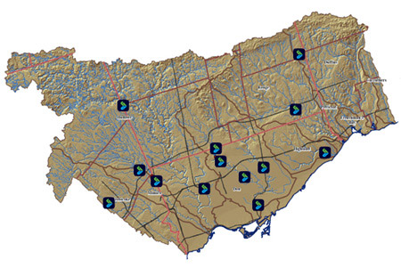
TRCA monitoring station map from trcagauging.caNot only can TRCA monitor the Don—indeed, all of the rivers under its purview—from its Downsview offices, but thanks to a new public web site (login with username “public” and password “public”), you can play Conservation Authority from the comfort of your parents’ basement. For more than a dozen locations, you can view real-time results from monitoring gauges, or graph water level and flow trends over time. There’s even a version of the data optimized for viewing on your Blackberry. With practice, you’ll be able to tell when the Bayview Extension is flooding or when your new bridge is in danger of being washed out. And yes, you can even see the current view from that camera pointed up the Don. What more could a budding environmentalist, river geek, or curious writer ask for? The site is still under active development and will eventually have more features and display data from more gauge stations.

Most of this is probably not terribly exciting to the majority of people, but it’s notable as one of the few online government projects that gives the public access to detailed real-time information rather than just watered-down summaries after the fact. Most effort of this variety seems to be directed towards car drivers, showing not only camera views, but also providing analysis of current driving speeds. It’s a little refreshing to see agencies applying some of the same principles and technology to other uses.

Map from trcagauging.ca. Thanks to TRCA’s Don Haley for his assistance. A version of this article originally appeared on Torontoist.

Looks like the '80s

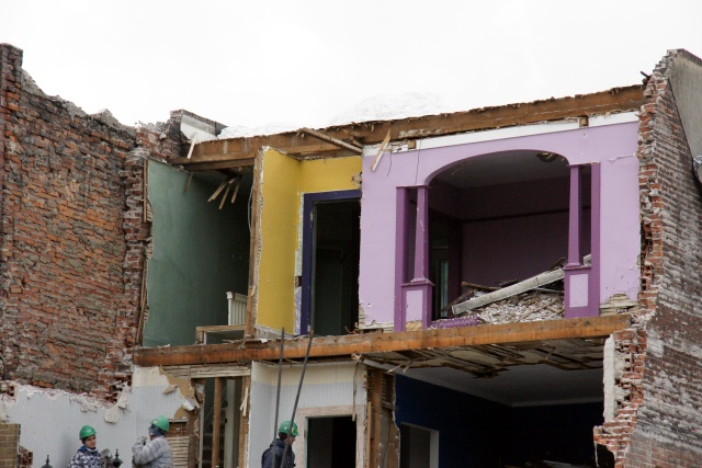
Colour uncovered at the Ralph Day Funeral HomeThe problem with demolitions is that all of your neighbours get to see the terrible colour choices you’ve made over the years. This unfortunate combination of green, yellow, and pastel purple has been uncovered during the demolition of the former Ralph Day Funeral Home on Danforth at Ellerbeck. Having never been inside the building before, I can’t say for sure whether these rooms were part of the funeral home or an adjacent apartment. Maybe it wasn’t so bad when the walls were intact and you could only see one colour at a time.

This building is being replaced by a Shoppers Drug Mart. Oh joy.

Pottery Road: The original Toronto Bypass

Somewhat related to my previous post, Pottery Road has a little-known connection to another Toronto street: Davenport Road. The East York Library monograph Fascinating Facts About East York (and some of them really are, at least to east-end geeks like me) says that Pottery Road:

may have been a part of an old Indian trail that crossed the city along what is now Davenport Road and entered the Don Valley through the Rosedale Valley ravine. There are records of the Mississauga Indians having encamped on the Don near Pottery Road as late as 1831.

I always find it interesting that so much of our modern infrastructure follows old trails, watercourses, and terrain, even decades or centuries after after the old features have ceased to exist on any meaningful level. Technology may have brought us huge bridges across the valley and personal motorized transportation, yet there’s Pottery Road, tracing an old footpath in the Don and still used by thousands of people a day. Some things never change.

Old Pottery Road walking tour

Pottery Road

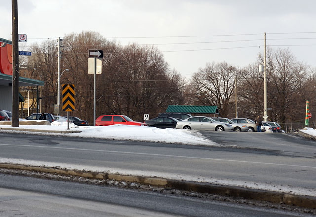
Frequent northbound travellers on the Bayview Extension have probably noticed the “Pottery Road” street sign pointing to a glorified supermarket driveway at the top of the hill, just south of Moore Avenue. Some may even have wondered how it relates to the more familiar street of the same name almost 1.5 kilometers to the south, winding up the valley wall to Broadview Avenue. The answer to this puzzle is that the two Pottery Roads used to be one, connecting Broadview and Moore Avenues, roughly following Cudmore Creek for much of its length.

Most of the road was abandoned when the Bayview Extension was constructed in the late 1950s. The section running from Broadview to Bayview was left mostly intact (and the top of it was later realigned to allow an easier climb out of the valley), as was a very short block at the northern end of the road, now flanked by parking lots for a supermarket and a bank.

What about the kilometer of the road that used to connect the two remaining sections? Unlike most abandoned roads that exist only for short stretches of their former selves, old Pottery Road is unique: its entire original route from Broadview to Moore is still open and can be hiked from beginning to end. Read on for the complete walking tour.

Read More …

Take a (snow) hike

Really big shoe

What’s the most fun you can have in the days following a big snowstorm?

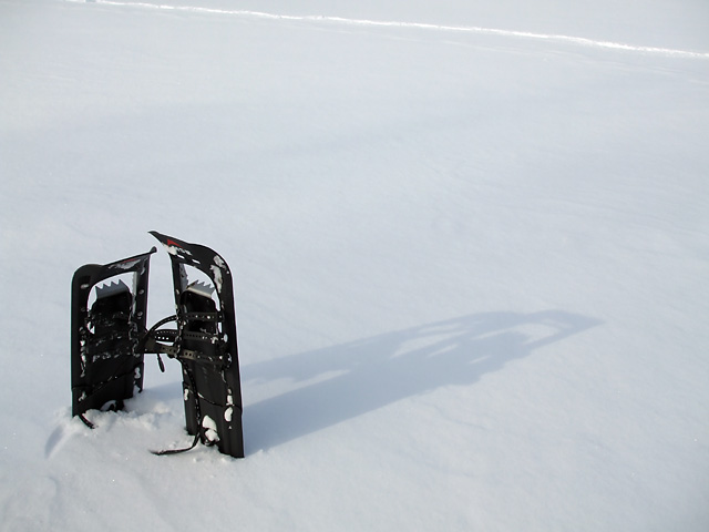
Unlike many winter sports, snowshoeing is relatively inexpensive and requires little in the way of specialized equipment. Other than the snowshoes themselves—a decent pair costs less than a good pair of skates—you need only some warm layers of clothing, a sense of adventure, and as much time as your legs can stand.

It really couldn’t be any easier to learn, either: just strap on your snowshoes and start walking your way to an energizing workout. Or take a slower pace and explore corners of the park where you wouldn’t normally go.

With terrain varying from wide open fields to challenging forested hiking trails, Toronto’s Rouge, Don, and Humber Valleys (not to mention dozens of smaller ravines and parks around the city) offer prime snowshoeing opportunities without requiring travel outside the city. If you live or work close to a suitable park, snowshoeing is hard to beat as a lunchtime fitness activity. It’s mind-clearing and relaxing, and leaves you ready to tackle whatever boredom awaits you at the office in the afternoon.

The only real barrier to snowshoeing in the city is Toronto’s wimpy weather: with frequent thaw cycles throughout the winter, ideal snowshoeing conditions usually only last for a few days after a big storm before all the snow starts melting away into slush.

If you feel the need to go farther afield and escape the city, check out the offerings of a local organization like the Toronto Bruce Trail Club or Outing Club of East York for group snowshoe hikes through conservation areas or resorts outside the city. From the base of frozen Webster’s Falls to the top of Rattlesnake Point, there’s no shortage of snowshoeing challenges in and around the GTA. Sites outside Toronto usually hang onto their snow longer than we do in the city, but you should always check conditions at your destination before heading out.

What if you don’t have snowshoes and don’t want to buy them? You can always rent from the MEC or one of many winter resorts in southern Ontario. For those inclined to frugality or craftiness, there are do-it-yourself instructions available online for several different varieties of snowshoes. You have no excuse not to try it.

So what’s the most fun you can have in the days following a big snowstorm? Tobogganing, of course. Snowshoeing doesn’t even come close, but it’s still fun in its own way.

A version of this article originally appeared on Torontoist.
Rink in the raw

Natural ice rink in E.T. Seton Park

There’s something about the sight of a natural skating rink that warms the heart. I noticed on Monday that someone had cleared a good-sized rink on the marsh in E.T. Seton Park. The marsh was pretty completely frozen over last week and I wondered how suitable it would be for skating. I guess someone found out.

Natural ice rink in E.T. Seton Park, gone until the next freeze

Of course, by Wednesday, the party poopers at the City had put up new “Ice Unsafe” and “No Skating” signs and melted all of the ice. Those fun-hating bastages. I don’t mind the signs so much, but they could have left the rink intact.

Despite the relative deep freeze of the last couple of weeks, I think it was still a little early to be heading out on natural ice. The ice looked solid even on Monday, but I wasn’t going anywhere near it. Call me paranoid, but I can wait until a proper January freeze.

The “No Skating” signs include a hand-lettered reference to Chapter 608 of the Toronto Municipal Code, section 21B of which states that, “No person shall access or skate on a natural ice surface in a park where it is posted to prohibit it.” Are there any natural ice surfaces in Toronto that don’t get “No Skating” signs posted every winter? Last I heard, even Grenadier Pond gets this treatment. Signs also line the banks of the Don River, and I can’t remember ever seeing that chemical soup frozen over. I did snowshoe across Taylor Creek once a few years ago, but only because I knew the river was about three inches deep below the ice.