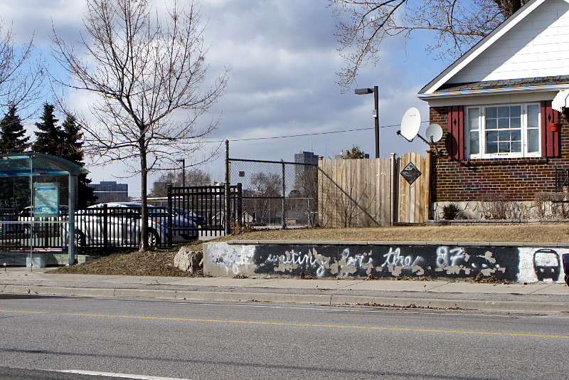
This graffito at a Cosburn 87 bus stop has been flaking off for quite a while now. Whether it was authorized or just tolerated by the homeowner, it’s a simple yet fabulous site-specific artwork.
Random Wanderings and Wonderings

This graffito at a Cosburn 87 bus stop has been flaking off for quite a while now. Whether it was authorized or just tolerated by the homeowner, it’s a simple yet fabulous site-specific artwork.
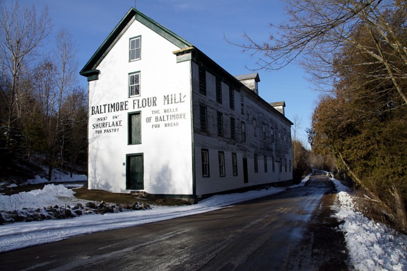
Ball’s Mill graces the Hamlet of Baltimore north of Cobourg. Although the exterior has been restored and is largely in good condition, the inside is crammed full of junk and looks pretty rough through the windows.
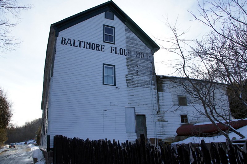
Behind the mill, a portion of the exterior has been left unrestored to show the original condition:
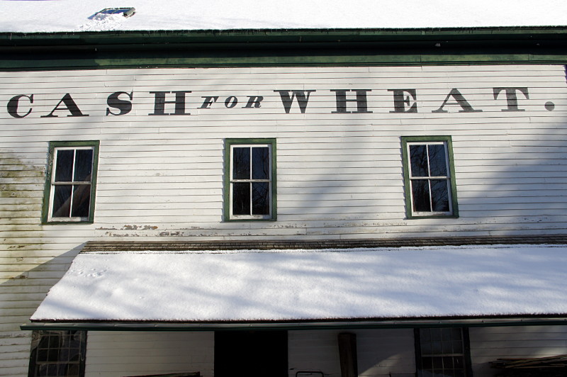
Apparently, the mill was run by a 19th-century Russell Oliver:
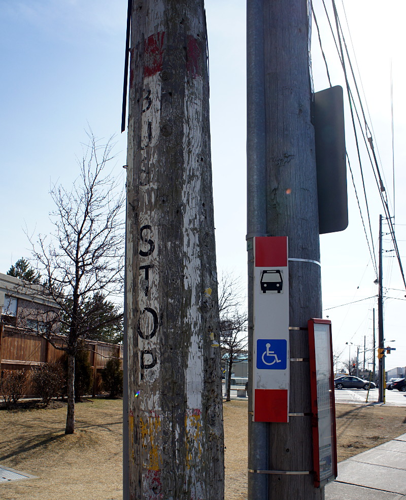
Before the TTC started marking bus stops by strapping mass-produced metal* vinyl signs onto poles, they used stencils and paint. I’m not sure when they stopped doing that, but I do vaguely remember the metal signs becoming standard in maybe the early 80s. Most of those old painted signs have disappeared or faded with time, but a few of them are still kicking around on old streetcar and bus routes. The one above is painted on an old utility pole on the east side of Sloane Avenue just north of Eglinton Avenue East. The old pole has been cut down to just above the ghost stop, leaving it with no role other than displaying a bit of old paint. As you can see in this Google Street View, the metal sign was strapped over the painted one before the new pole was installed.
Another TTC ghost is on the southwest corner of Kingston Road and Glen Manor Drive:
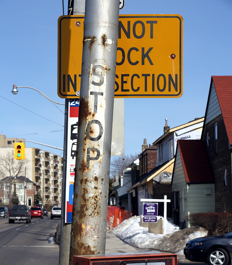
As you can tell by the snow on the lawns in the background, the picture wasn’t taken this winter. It looks like this stop was originally on a TTC-specific pole that carried the trolley wire for powering streetcars on this line. I’m not sure why the old pole survived; like the one on Sloane above, it seems to serve no specific function any longer.
Without a doubt, the best TTC ghost stops were in the Wychwood streetcar barns, where decommissioned poles were cut up and used as building material to shore up the floor above:
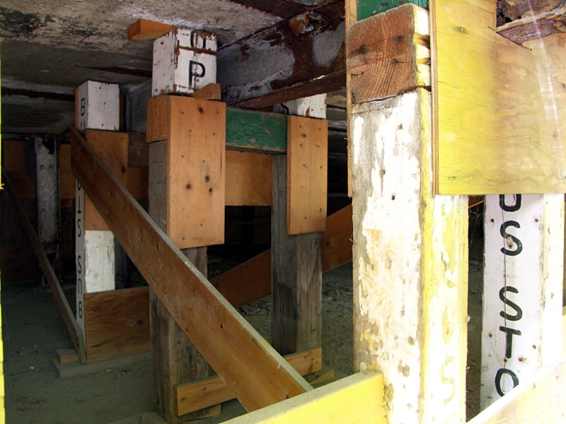
It’s extremely unlikely that any part of these ad hoc posts and beams survived the conversion of the buildings into the Artscape Wychwood Barns, but it was an amazing surprise to see when it was there.
* Update, March 16, 2012: The newer non-painted signs are actually vinyl, not metal.
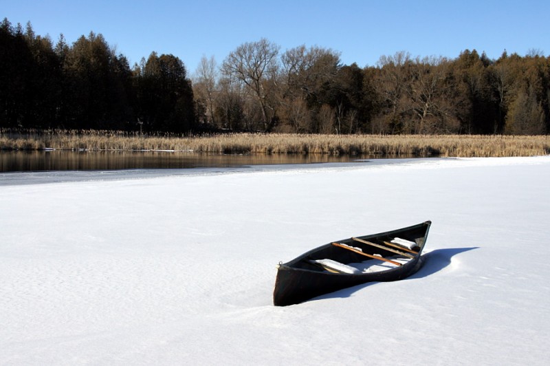
Spring’s coming, but it’s not here quite yet.

The more keys the merrier, which is why my key ring is so happy that spring is on the way: he’ll get to carry my bike keys more often.
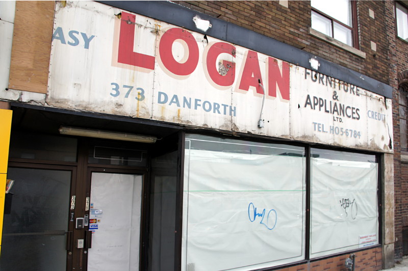
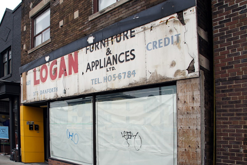
A great ghost sign was uncovered on the Danforth at Chester Avenue last week. The sign for Logan Furniture & Appliances had been hidden behind the facade of Parthenon Jewellery, which closed last year. A small corner of the ghost sign was revealed after a pop-up store hung its shingle for a few weeks leading up to Christmas, and the entire old sign was uncovered just a few days ago.
Worth noting is the old-style phone number giving the exchange name of HO (HOward) for the first two digits. Also worth noting is that even back then, “easy credit” was a big selling point.
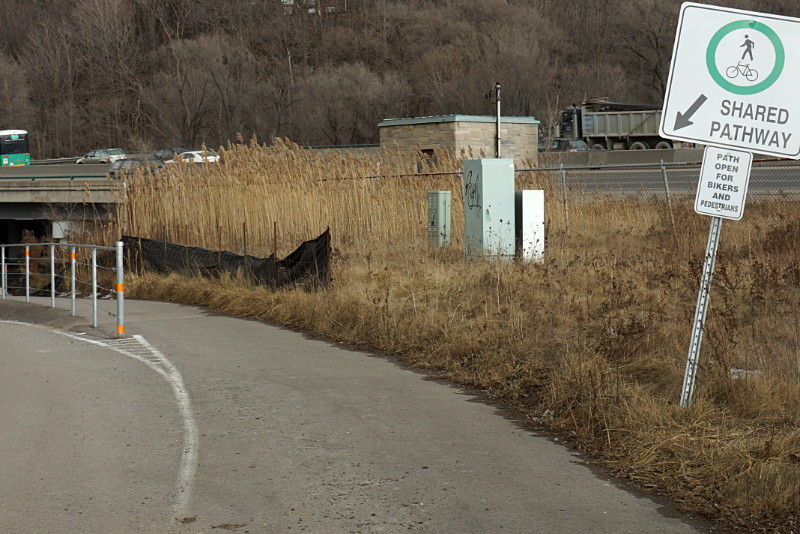
In Taylor Creek Park near the forks of the Don, a raised pathway was installed a while ago so that pedestrians and cyclists wouldn’t have to contend with vehicular traffic on the park roadway. When you’re heading east into the park, the shared path beckons to cyclists, explicitly declaring that it’s “open for bikers [sic] and pedestrians”:
But at the other end of the path, cyclists heading west out of the park are sternly instructed to dismount:
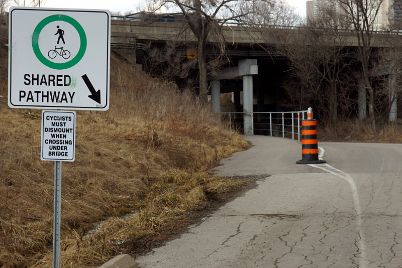
To be clear, this is the same “shared pathway,” only about 100 metres long, and built with the express purpose of giving safe passage under the Don Valley Parkway away from cars on the park road. And although it’s signed as a shared pathway at both ends, it seems that only eastbound cyclists are actually allowed to ride their bikes.
If the pathway is too narrow to allow cyclists to ride in both directions while mingling with pedestrians (an assessment I wouldn’t disagree with), or if there’s a blind corner that makes riding full-bore unsafe, why weren’t those issues addressed during design and construction? Or better yet, why not just mark it as a pedestrian walkway and encourage cyclists to just take the road, which is the route still chosen by the vast majority of cyclists anyway?
Ironically, the raised path would be of most use to westbound cyclists because it doesn’t dip as low under the bridge as the roadway does, making the short hill on the far side easier to climb. Yet it’s westbound cyclists who are singled out for dismounting. Personally, I think that if the city wants this passage to be safer, it should instruct drivers to get out of their cars and push. After all, there’s a blind corner and the lanes are a little narrow…
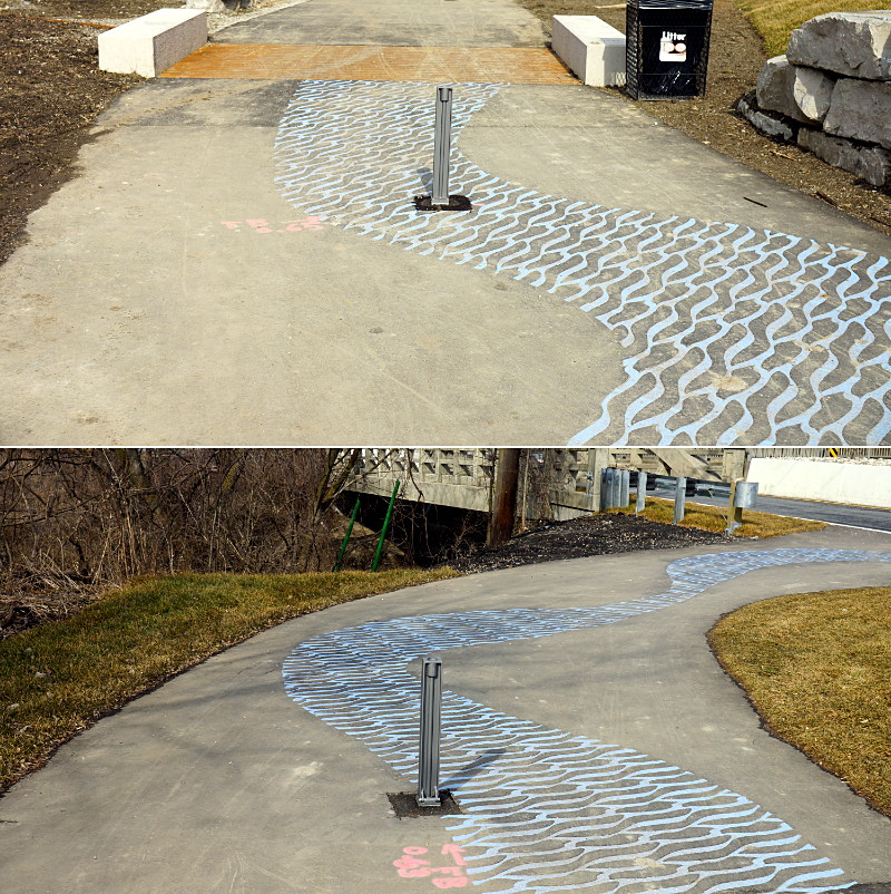
Holes for new bollards were cut into the middle of the asphalt ripple pattern on the Lower Don trail.
Less than two months after the upgraded Pottery Road crossing of the Lower Don trail was officially opened to a single rave review (as far as I know, I’m the only one who cared enough to review it), the city had already taken a knife to the artistic blue asphalt ripples to install a couple of bollards to prevent unauthorized vehicular access to the mixed-use path. I don’t have a problem with the bollards themselves, but would it have killed the installation crew to move them forward or backward a couple of feet and place them on the plain black asphalt instead of cutting into the middle of the embedded pattern? And did they have to make the same poor placement choice on the paths on both the north and south sides of Pottery Road? Anticipating the need for bollards during the main work would have allowed them to be installed without having to cut an ugly square patch out of freshly laid asphalt. Even looking at it now, I’m not really sure why the cuts were necessary.
This is such a small detail in the context of the much larger Pottery Road reconstruction that it probably didn’t merit any specific design other than someone jabbing a finger at a drawing roughly where each bollard should go and someone else going down to Bollards R Us to pick up a pair of the current preferred model. I can’t imagine that there was any real requirement to place the bollards exactly where they did, nor that moving them a little bit would create a problem of any kind or cause them to be any less effective. So if there are no drawbacks, why wouldn’t you install them in a way that doesn’t degrade something unique that’s already there? And while this particular incident isn’t really worth getting too worked up about, the carelessness shown here is depressing only because it’s so endemic to public works in Toronto that overcoming it seems impossible.
(Yes, this is my seventh post about the Pottery Road reconstruction. Will it be the last? Probably. At least until next month.)
I mentioned Presqu’ile Provincial Park’s horse trees—Risa prefers the term “camel trees”—in my anniversary gallery post last week. They’re so-called because their swaybacked trunks resemble saddles and people (including Risa and me) love sitting on them for pictures. Trees like this aren’t unique to Presqu’ile, but what is unique is that there are several dozen of them concentrated in a small grove and are all presumed to have developed their distinctive form as a result of the same weather event about 120 years ago.
Ball’s Mill Conservation Area, north of Cobourg in the hamlet of Baltimore, has a few horse trees too and one of them is remarkable for having not only a saddle, but what appears to be a front limb and a very long neck too:
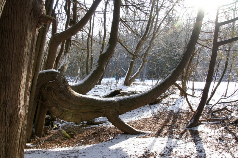
You can see a couple of additional views of this tree and the explanation of this kind of formation from the info board at Presqu’ile after the jump.
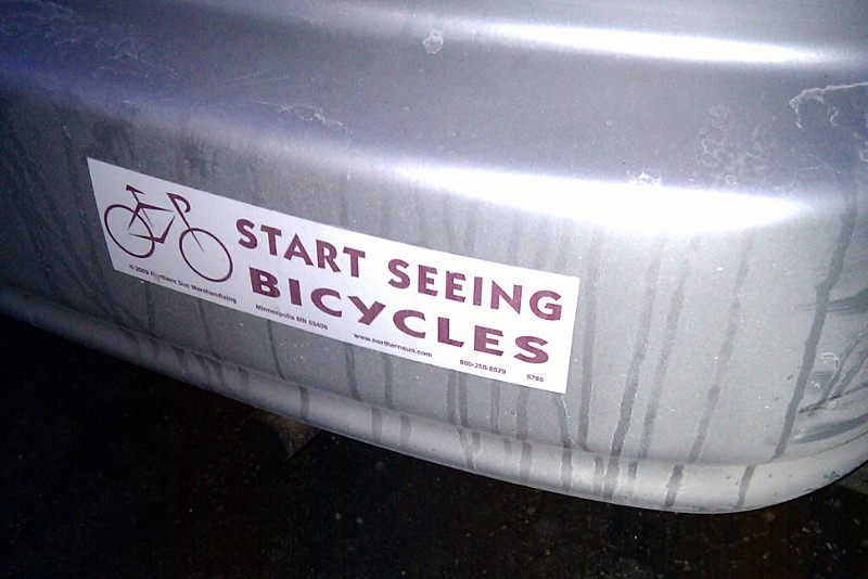
I saw this bumper sticker last night on my way to, appropriately enough, an organizing meeting for Ward 29 Bikes.
Whenever I’m riding in traffic, I’m always secretly grateful to the people who blast their horns and yell at me out their windows. It’s not that I appreciate their road rage or get-outta-my-way entitlement, it’s that if nothing else, I know that they’ve seen me. And drivers who see me, and who know I’m in front of them, and whose rage tacitly acknowledges that they can’t get around me without changing lanes, scare me a lot less than the ones who show up in my mirror while looking down at their cell phones, engaging their passengers in animated conversation, or fiddling with the radio. Those drivers may get away with it most of the time, but they are the ones who really need to start seeing bicycles.
I’d say the same about the people at Lifehacker, who last week posted an article about how car drivers could prevent dooring cyclists. Unfortunately, they stuck with the lazy “invisible cyclists” narrative while transferring the responsibility of motorists to do something as simple as safely opening their doors onto those dastardly bikers:
It has likely happened to all of us: we’re casually opening the door of a car when another car or bike comes whizzing past, nearly hitting the door because they didn’t see it opening. Instructables user milesfromnelhu recognized the problem and decided to fix it by spray painting a warning strip on the inside of the door.
[…]
It’s true you should be looking in your side mirror before popping open the door, but it doesn’t always happen. Smaller vehicles like motorcycles or bicycles might still be invisible when you look in the mirror.
As a cyclist, I have to say that I try to use my powers of invisibility much more sparingly than the above statement would suggest. Still, I always hear that I “came out of nowhere” or that a driver simply “didn’t see” me. As I’ve said elsewhere, if you don’t see me, it’s not because putting a bicycle between my legs activates my cloak of invisibility, it’s because you aren’t paying attention.
If you look at the language in the Lifehacker post, it excuses the person who creates the dangerous situation (the driver opening the door) while laying the blame on the victim (the person about to be hit by it):
And that’s just in a short two-paragraph article. Unfortunately, it reflects how a lot of motorists feel not just about bikes, but about all other traffic, including pedestrians.
Some motorists often have a knee-jerk reaction against cyclists and cycling infrastructure because they think that our goal is to force them to ride bicycles everywhere. In truth, we just want to be seen. But all of the lights, reflective strips, helmets, mirrors, and DayGlo jackets in the world won’t do us any good if you’re not looking for us. So by all means, stay in your car. But please start seeing bicycles.