Another TTC ghost stop

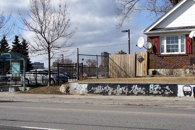
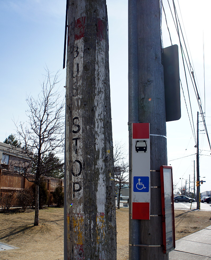
East face of TTC ghost stop on Gerrard at Jones

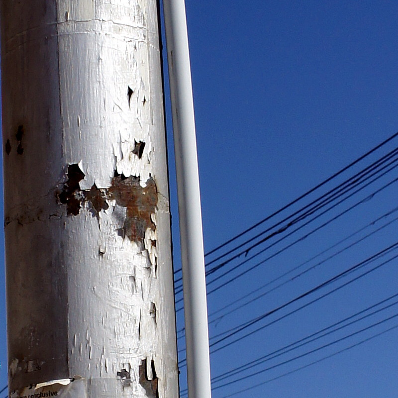
Here’s another TTC ghost sign, this one on the northeast corner of Gerrard Street at Jones Avenue. The east face, above, is hard to miss. The west face is much more faded but the “AR S” of “CAR STOP” is still barely visible. In the photo of the west face below, you can see the bright white rectangle of the original sign as well as very faint outlines of the “R” and “S” just above and below the big rust patch in the middle of the post:

West face of TTC ghost stop on Gerrard at Jones

A little farther east on Gerrard there’s also a ghost Sunday stop, but it’s only visible as an area of faded yellow paint on a utility pole with no discernible lettering.

Ball’s Mill

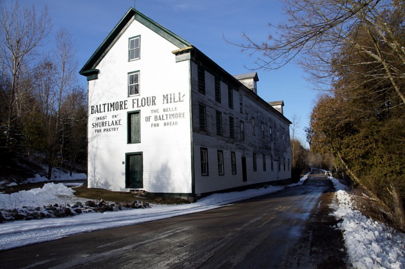
Ball's Mill

Ball’s Mill graces the Hamlet of Baltimore north of Cobourg. Although the exterior has been restored and is largely in good condition, the inside is crammed full of junk and looks pretty rough through the windows.

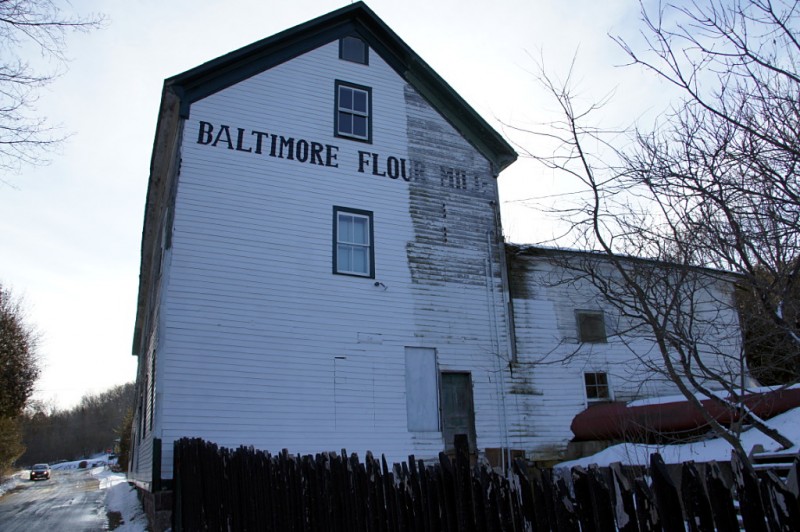
Behind the mill, a portion of the exterior has been left unrestored to show the original condition:

Rear view of Ball's Mill

Apparently, the mill was run by a 19th-century Russell Oliver:

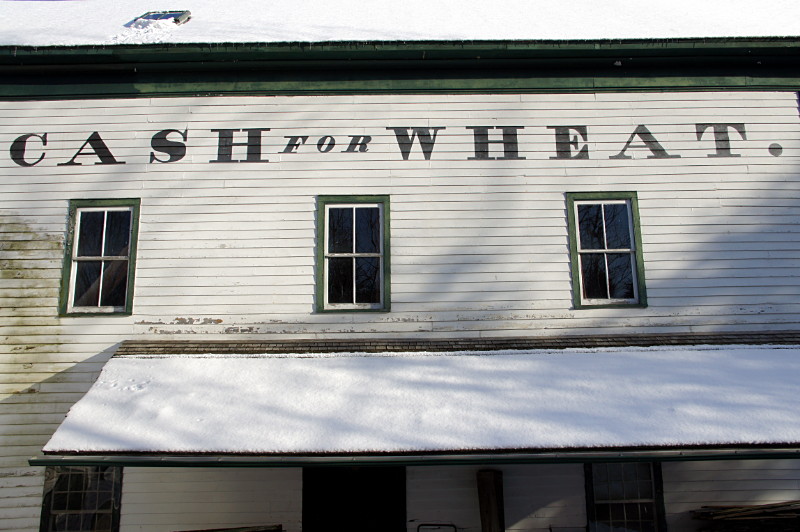
Cash for Wheat at Ball's Mill

TTC ghost stops

TTC ghost sign on Sloane at Eglinton

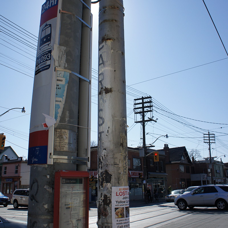
Before the TTC started marking bus stops by strapping mass-produced metal* vinyl signs onto poles, they used stencils and paint. I’m not sure when they stopped doing that, but I do vaguely remember the metal signs becoming standard in maybe the early 80s. Most of those old painted signs have disappeared or faded with time, but a few of them are still kicking around on old streetcar and bus routes. The one above is painted on an old utility pole on the east side of Sloane Avenue just north of Eglinton Avenue East. The old pole has been cut down to just above the ghost stop, leaving it with no role other than displaying a bit of old paint. As you can see in this Google Street View, the metal sign was strapped over the painted one before the new pole was installed.

Another TTC ghost is on the southwest corner of Kingston Road and Glen Manor Drive:
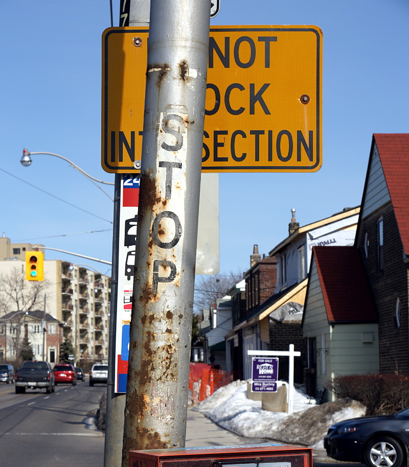
TTC ghost sign on Kingston at Glen Manor

As you can tell by the snow on the lawns in the background, the picture wasn’t taken this winter. It looks like this stop was originally on a TTC-specific pole that carried the trolley wire for powering streetcars on this line. I’m not sure why the old pole survived; like the one on Sloane above, it seems to serve no specific function any longer.

Without a doubt, the best TTC ghost stops were in the Wychwood streetcar barns, where decommissioned poles were cut up and used as building material to shore up the floor above:
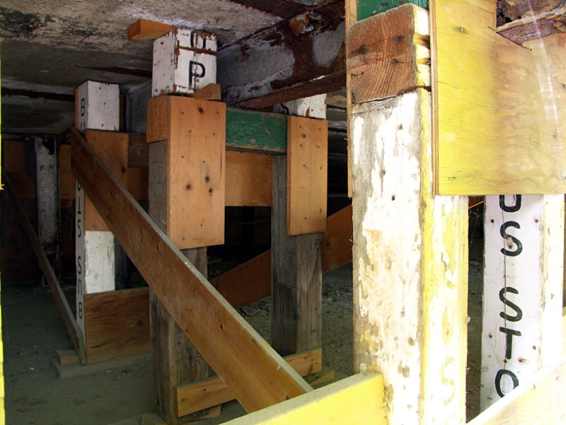
TTC ghost stops holding up the floor in the Wychwood car barns

It’s extremely unlikely that any part of these ad hoc posts and beams survived the conversion of the buildings into the Artscape Wychwood Barns, but it was an amazing surprise to see when it was there.

* Update, March 16, 2012: The newer non-painted signs are actually vinyl, not metal.
Logan Furniture ghost sign

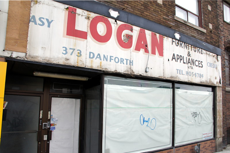
Logan Furniture & Appliances ghost sign on Danforth Ave.

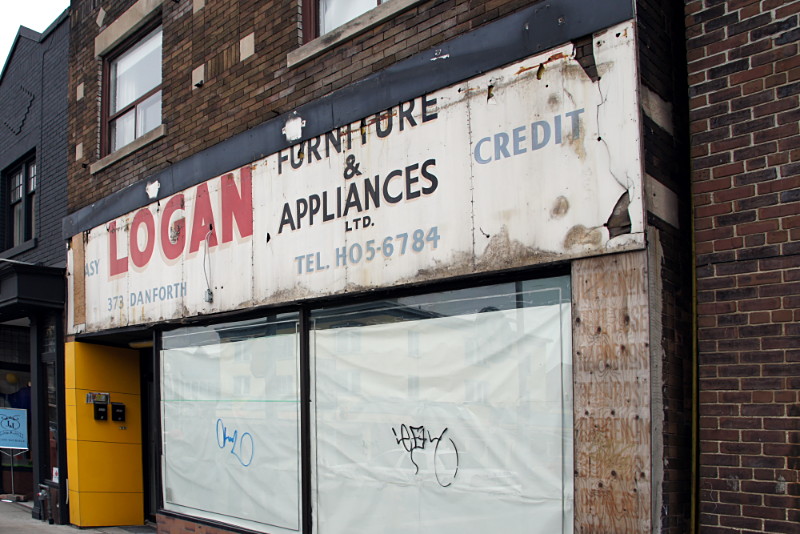
Logan Furniture & Appliances ghost sign on Danforth Ave.

A great ghost sign was uncovered on the Danforth at Chester Avenue last week. The sign for Logan Furniture & Appliances had been hidden behind the facade of Parthenon Jewellery, which closed last year. A small corner of the ghost sign was revealed after a pop-up store hung its shingle for a few weeks leading up to Christmas, and the entire old sign was uncovered just a few days ago.

Worth noting is the old-style phone number giving the exchange name of HO (HOward) for the first two digits. Also worth noting is that even back then, “easy credit” was a big selling point.

Horse trees

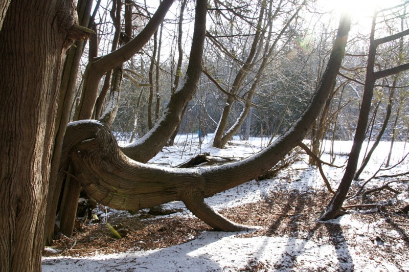
I mentioned Presqu’ile Provincial Park’s horse trees—Risa prefers the term “camel trees”—in my anniversary gallery post last week. They’re so-called because their swaybacked trunks resemble saddles and people (including Risa and me) love sitting on them for pictures. Trees like this aren’t unique to Presqu’ile, but what is unique is that there are several dozen of them concentrated in a small grove and are all presumed to have developed their distinctive form as a result of the same weather event about 120 years ago.

Ball’s Mill Conservation Area, north of Cobourg in the hamlet of Baltimore, has a few horse trees too and one of them is remarkable for having not only a saddle, but what appears to be a front limb and a very long neck too:

Horse tree at Ball's Mill CA

You can see a couple of additional views of this tree and the explanation of this kind of formation from the info board at Presqu’ile after the jump.

Read More …

Cottonwood Flats Slab City


Slab City in Cottonwood Flats

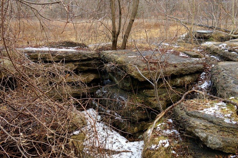
The strangest thing in Cottonwood Flats is what my fellow Don Valley explorer Rudy Limeback calls “Slab City.” That’s as good a name as any that I can think of, so I’m going to run with it. Slab City is a series of concrete and asphalt slabs piled about 5–7 feet high that runs along the bank of the Don River in Cottonwood Flats. A very short portion of Slab City is visible in this view from Bing Maps as the jumble of big square rocks near the middle of the frame. I don’t know anything about the origin of the slabs, or when or why they were placed along the river. I do know that their placement predates my first bike ride around the site sometime in the late 80s. They are all reinforced concrete and some have a layer of asphalt on top of them, so I’d speculate that they were part of a bridge deck at one point. The Leaside Bridge was rebuilt in the 1960s and is close enough that this site would have been a convenient dumping ground. That’s just conjecture, though. A more fanciful conjecture is that they’re the remnants of the Bayview Ghost. Note that I don’t actually believe this to be the case, but wouldn’t it be awesome if it was? Check out the short gallery of Slab City below the fold.

Read More …

Cottonwood Flats

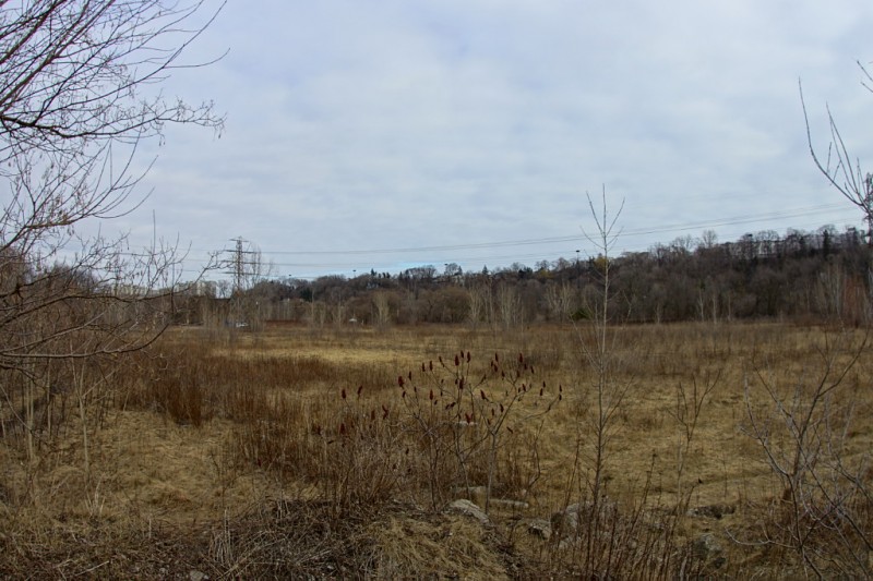
Overview of Cottonwood Flats

Cottonwood Flats [PDF] in the Don Valley is no stranger to industrial degradation. Before being used as a snow dump by the city, the site was home to a series of mills and factories beginning more than 200 years ago (here’s an interactive map of Cottonwood Flats, Crothers Woods, and adjacent areas). I remember tooling around the trails on my bike and navigating around the big sloppy pile of dirty ice and garbage that still towered overhead in the middle of the valley floor as late as June some years. Recognizing that it’s not really a good idea to use a site that drains directly into the Don River as a dumping ground, the city finally ended its use as a snow dump in 2009. It has since been renaturalizing and there is supposed to be a new management plan that I haven’t been able to find online.

As you can see from the picture above, Cottonwood Flats in winter is very much a reflection of Toronto itself at this time of year: flat, barren, and relentlessly brown. With the DVP just across the way, the Bayview Extension at the top of the hill, and two railways nearby, there’s no mistaking this for a bit of pristine wilderness in the middle of nowhere. At first glance it seems like little more than an overgrown field beside a noisy highway, but the site’s edges, especially along the river, are filled with winding paths that carry you to a variety of interesting nooks and crannies. In the last few years, it’s also grown to be a much more popular destination for cyclists, families, and especially dog walkers. I’ve seen more people on my two recent visits this winter than I ever used to during the summer. Read below the fold for the first of two short galleries (or second of three, if you include the one from a couple of weeks ago) looking at a few of the interesting sights.

Read More …

Cottonwood Flats ice curtain

Ice curtain around the Don River

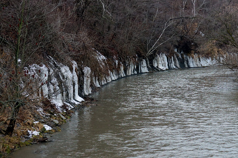
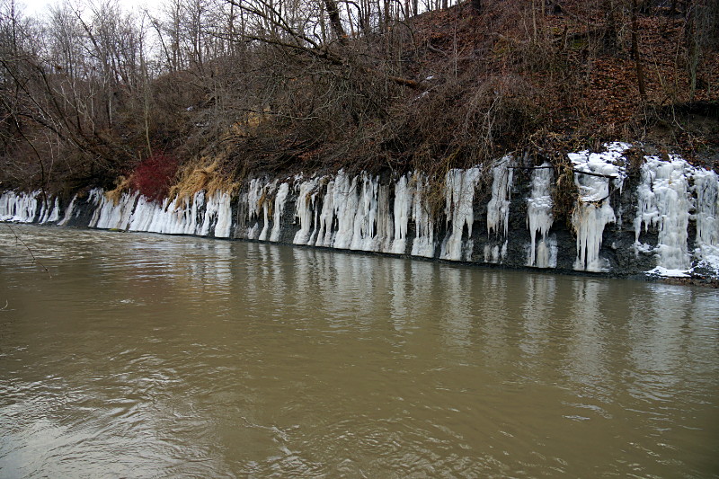
There’s an interesting sight on the Don River north of Pottery Road. Just across the river from Cottonwood Flats, a series of icicles dripping from the hillside create an ice curtain that curves for about 200 metres along the river bank.

Ice curtain around the Don River

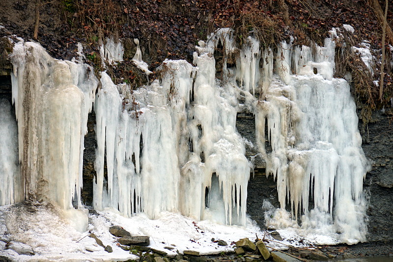
Although a few of the individual icicles can be traced to water channels that trickle down from the top of the hill, most seem to sprout from the hillside just a few metres above the river:

Ice curtain detail

Given the extent and uniformity of the ice, my guess is that most of it comes from groundwater seeping into the river at this location.